You are here: Home > Network List > GT - Global Telemetered Seismograph Network (USAF/USGS) Stations List
> Station LPAZ La Paz , Bolivia > Earthquake Result Viewer
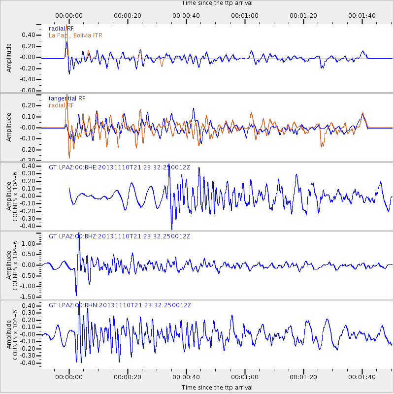
LPAZ La Paz , Bolivia - Earthquake Result Viewer
*The percent match for this event was below the threshold and hence no stack was calculated.
| Earthquake location: |
Pacific-Antarctic Ridge |
| Earthquake latitude/longitude: |
-54.9/-130.6 |
| Earthquake time(UTC): |
2013/11/10 (314) 21:13:49 GMT |
| Earthquake Depth: |
10 km |
| Earthquake Magnitude: |
5.6 MWB, 5.8 MWC |
| Earthquake Catalog/Contributor: |
NEIC PDE/NEIC COMCAT |
|
| Network: |
GT Global Telemetered Seismograph Network (USAF/USGS) |
| Station: |
LPAZ La Paz , Bolivia |
| Lat/Lon: |
16.17 S/68.08 W |
| Elevation: |
4817 m |
|
| Distance: |
61.2 deg |
| Az: |
76.627 deg |
| Baz: |
215.759 deg |
| Ray Param: |
$rayparam |
*The percent match for this event was below the threshold and hence was not used in the summary stack. |
|
| Radial Match: |
66.83935 % |
| Radial Bump: |
400 |
| Transverse Match: |
62.128677 % |
| Transverse Bump: |
400 |
| SOD ConfigId: |
626651 |
| Insert Time: |
2014-04-19 13:13:36.333 +0000 |
| GWidth: |
2.5 |
| Max Bumps: |
400 |
| Tol: |
0.001 |
|
Signal To Noise
| Channel | StoN | STA | LTA |
| GT:LPAZ:00:BHZ:20131110T21:23:32.250012Z | 6.071016 | 5.986433E-7 | 9.860677E-8 |
| GT:LPAZ:00:BHN:20131110T21:23:32.250012Z | 3.5612192 | 2.0165716E-7 | 5.6625872E-8 |
| GT:LPAZ:00:BHE:20131110T21:23:32.250012Z | 2.5798914 | 1.875128E-7 | 7.268243E-8 |
| Arrivals |
| Ps | |
| PpPs | |
| PsPs/PpSs | |


