You are here: Home > Network List > TA - USArray Transportable Network (new EarthScope stations) Stations List
> Station Q24A Divide, CO, USA > Earthquake Result Viewer
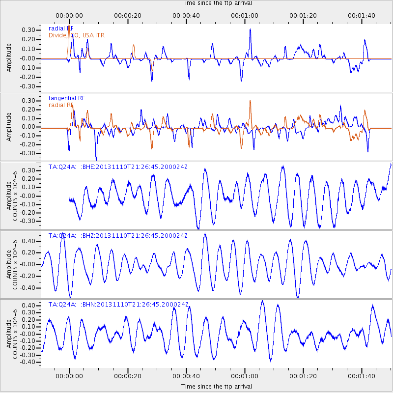
Q24A Divide, CO, USA - Earthquake Result Viewer
*The percent match for this event was below the threshold and hence no stack was calculated.
| Earthquake location: |
Pacific-Antarctic Ridge |
| Earthquake latitude/longitude: |
-54.9/-130.6 |
| Earthquake time(UTC): |
2013/11/10 (314) 21:13:49 GMT |
| Earthquake Depth: |
10 km |
| Earthquake Magnitude: |
5.6 MWB, 5.8 MWC |
| Earthquake Catalog/Contributor: |
NEIC PDE/NEIC COMCAT |
|
| Network: |
TA USArray Transportable Network (new EarthScope stations) |
| Station: |
Q24A Divide, CO, USA |
| Lat/Lon: |
38.96 N/105.15 W |
| Elevation: |
2775 m |
|
| Distance: |
96.0 deg |
| Az: |
19.667 deg |
| Baz: |
194.429 deg |
| Ray Param: |
$rayparam |
*The percent match for this event was below the threshold and hence was not used in the summary stack. |
|
| Radial Match: |
64.454544 % |
| Radial Bump: |
400 |
| Transverse Match: |
64.36904 % |
| Transverse Bump: |
400 |
| SOD ConfigId: |
626651 |
| Insert Time: |
2014-04-19 13:18:52.806 +0000 |
| GWidth: |
2.5 |
| Max Bumps: |
400 |
| Tol: |
0.001 |
|
Signal To Noise
| Channel | StoN | STA | LTA |
| TA:Q24A: :BHZ:20131110T21:26:45.200024Z | 1.9620883 | 2.9901057E-7 | 1.5239405E-7 |
| TA:Q24A: :BHN:20131110T21:26:45.200024Z | 1.2129529 | 2.0555838E-7 | 1.6946939E-7 |
| TA:Q24A: :BHE:20131110T21:26:45.200024Z | 1.5061374 | 1.6072153E-7 | 1.0671107E-7 |
| Arrivals |
| Ps | |
| PpPs | |
| PsPs/PpSs | |


