You are here: Home > Network List > HV - Hawaiian Volcano Observatory Network Stations List
> Station MLOD Mauna Loa, Hawaii Digital > Earthquake Result Viewer
MLOD Mauna Loa, Hawaii Digital - Earthquake Result Viewer
*The percent match for this event was below the threshold and hence no stack was calculated.
| Earthquake location: |
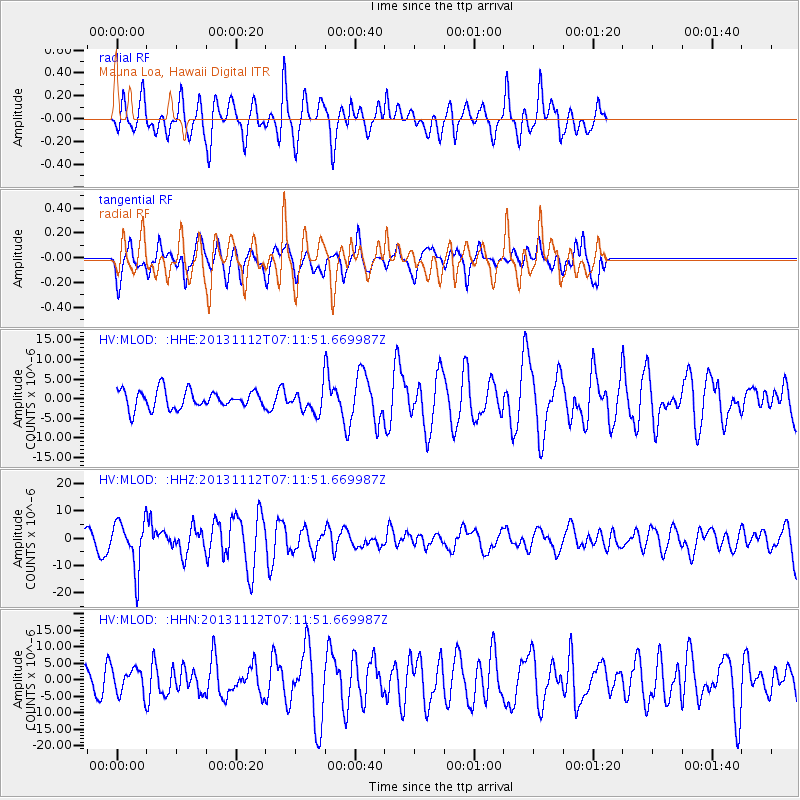
Near East Coast Of Kamchatka |
| Earthquake latitude/longitude: |
54.7/162.3 |
| Earthquake time(UTC): |
2013/11/12 (316) 07:03:51 GMT |
| Earthquake Depth: |
43 km |
| Earthquake Magnitude: |
6.4 MWW, 6.3 MWC, 6.4 MWW, 6.4 MWB, 6.5 MWC, 6.6 MI |
| Earthquake Catalog/Contributor: |
NEIC PDE/NEIC COMCAT |
|
| Network: |
HV Hawaiian Volcano Observatory Network |
| Station: |
MLOD Mauna Loa, Hawaii Digital |
| Lat/Lon: |
19.49 N/155.39 W |
| Elevation: |
2044 m |
|
| Distance: |
47.5 deg |
| Az: |
120.587 deg |
| Baz: |
328.005 deg |
| Ray Param: |
$rayparam |
*The percent match for this event was below the threshold and hence was not used in the summary stack. |
|
| Radial Match: |
59.738815 % |
| Radial Bump: |
400 |
| Transverse Match: |
64.1726 % |
| Transverse Bump: |
400 |
| SOD ConfigId: |
626651 |
| Insert Time: |
2014-04-19 13:33:16.057 +0000 |
| GWidth: |
2.5 |
| Max Bumps: |
400 |
| Tol: |
0.001 |
|
Signal To Noise
| Channel | StoN | STA | LTA |
| HV:MLOD: :HHZ:20131112T07:11:51.669987Z | 2.7729979 | 8.706039E-6 | 3.1395766E-6 |
| HV:MLOD: :HHN:20131112T07:11:51.669987Z | 0.75657594 | 3.7389686E-6 | 4.941961E-6 |
| HV:MLOD: :HHE:20131112T07:11:51.669987Z | 1.2421501 | 2.8861086E-6 | 2.3234784E-6 |
| Arrivals |
| Ps | |
| PpPs | |
| PsPs/PpSs | |


