You are here: Home > Network List > II - Global Seismograph Network (GSN - IRIS/IDA) Stations List
> Station CMLA Cha de Macela, Sao Miguel Island, Azores > Earthquake Result Viewer
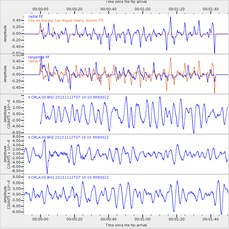
CMLA Cha de Macela, Sao Miguel Island, Azores - Earthquake Result Viewer
*The percent match for this event was below the threshold and hence no stack was calculated.
| Earthquake location: |
Near East Coast Of Kamchatka |
| Earthquake latitude/longitude: |
54.7/162.3 |
| Earthquake time(UTC): |
2013/11/12 (316) 07:03:51 GMT |
| Earthquake Depth: |
43 km |
| Earthquake Magnitude: |
6.4 MWW, 6.3 MWC, 6.4 MWW, 6.4 MWB, 6.5 MWC, 6.6 MI |
| Earthquake Catalog/Contributor: |
NEIC PDE/NEIC COMCAT |
|
| Network: |
II Global Seismograph Network (GSN - IRIS/IDA) |
| Station: |
CMLA Cha de Macela, Sao Miguel Island, Azores |
| Lat/Lon: |
37.76 N/25.52 W |
| Elevation: |
429 m |
|
| Distance: |
87.7 deg |
| Az: |
6.201 deg |
| Baz: |
355.461 deg |
| Ray Param: |
$rayparam |
*The percent match for this event was below the threshold and hence was not used in the summary stack. |
|
| Radial Match: |
64.37092 % |
| Radial Bump: |
352 |
| Transverse Match: |
61.23713 % |
| Transverse Bump: |
388 |
| SOD ConfigId: |
626651 |
| Insert Time: |
2014-04-19 13:34:25.702 +0000 |
| GWidth: |
2.5 |
| Max Bumps: |
400 |
| Tol: |
0.001 |
|
Signal To Noise
| Channel | StoN | STA | LTA |
| II:CMLA:00:BHZ:20131112T07:16:03.868992Z | 3.1406927 | 4.256211E-6 | 1.3551822E-6 |
| II:CMLA:00:BH1:20131112T07:16:03.868992Z | 0.82429564 | 2.787598E-6 | 3.381794E-6 |
| II:CMLA:00:BH2:20131112T07:16:03.868992Z | 1.1642698 | 2.078755E-6 | 1.7854582E-6 |
| Arrivals |
| Ps | |
| PpPs | |
| PsPs/PpSs | |


