156A Sylvania, GA, USA - Earthquake Result Viewer
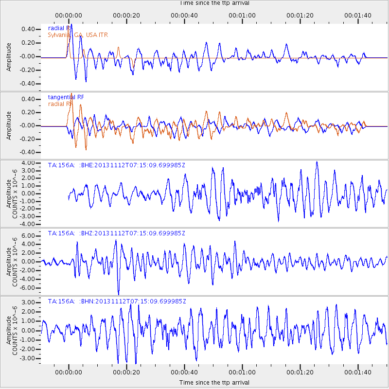
Earthquake location: Near East Coast Of Kamchatka
Earthquake latitude/longitude: 54.7/162.3
Earthquake time(UTC): 2013/11/12 (316) 07:03:51 GMT
Earthquake Depth: 43 km
Earthquake Magnitude: 6.4 MWW, 6.3 MWC, 6.4 MWW, 6.4 MWB, 6.5 MWC, 6.6 MI
Earthquake Catalog/Contributor: NEIC PDE/NEIC COMCAT
Network: TA USArray Transportable Network (new EarthScope stations)
Station: 156A Sylvania, GA, USA
Lat/Lon: 32.65 N/81.50 W
Elevation: 40 m
Distance: 77.2 deg
Az: 50.902 deg
Baz: 327.712 deg
Ray Param: 0.050386485
Estimated Moho Depth: 13.0 km
Estimated Crust Vp/Vs: 1.60
Assumed Crust Vp: 6.565 km/s
Estimated Crust Vs: 4.103 km/s
Estimated Crust Poisson's Ratio: 0.18
Radial Match: 86.4743 %
Radial Bump: 398
Transverse Match: 64.84148 %
Transverse Bump: 400
SOD ConfigId: 626651
Insert Time: 2014-04-19 13:46:35.966 +0000
GWidth: 2.5
Max Bumps: 400
Tol: 0.001

Signal To Noise

ChannelStoNSTALTA
TA:156A: :BHZ:20131112T07:15:09.699985Z3.7510851.743232E-64.647274E-7
TA:156A: :BHN:20131112T07:15:09.699985Z0.951516035.456411E-75.734439E-7
TA:156A: :BHE:20131112T07:15:09.699985Z1.13251468.665099E-77.651203E-7
Arrivals
Ps1.2 SECOND
PpPs5.0 SECOND
PsPs/PpSs6.2 SECOND