455A Stateville, GA, USA - Earthquake Result Viewer
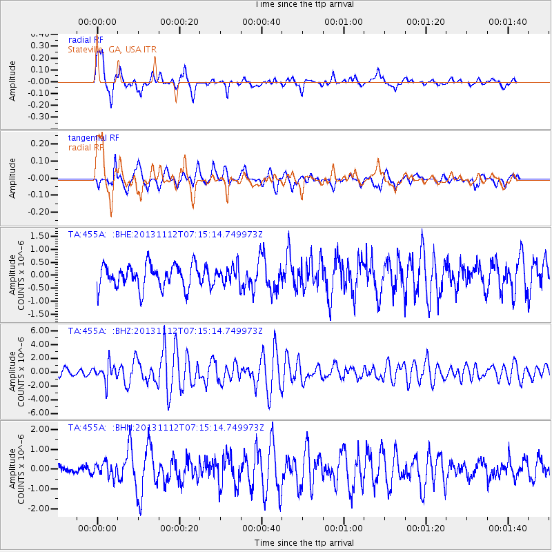
Earthquake location: Near East Coast Of Kamchatka
Earthquake latitude/longitude: 54.7/162.3
Earthquake time(UTC): 2013/11/12 (316) 07:03:51 GMT
Earthquake Depth: 43 km
Earthquake Magnitude: 6.4 MWW, 6.3 MWC, 6.4 MWW, 6.4 MWB, 6.5 MWC, 6.6 MI
Earthquake Catalog/Contributor: NEIC PDE/NEIC COMCAT
Network: TA USArray Transportable Network (new EarthScope stations)
Station: 455A Stateville, GA, USA
Lat/Lon: 30.74 N/83.03 W
Elevation: 44 m
Distance: 78.1 deg
Az: 53.076 deg
Baz: 327.375 deg
Ray Param: 0.04976927
Estimated Moho Depth: 54.75 km
Estimated Crust Vp/Vs: 1.65
Assumed Crust Vp: 6.565 km/s
Estimated Crust Vs: 3.978 km/s
Estimated Crust Poisson's Ratio: 0.21
Radial Match: 82.159454 %
Radial Bump: 395
Transverse Match: 73.983536 %
Transverse Bump: 400
SOD ConfigId: 626651
Insert Time: 2014-04-19 13:47:23.224 +0000
GWidth: 2.5
Max Bumps: 400
Tol: 0.001

Signal To Noise

ChannelStoNSTALTA
TA:455A: :BHZ:20131112T07:15:14.749973Z2.98288731.2905369E-64.326469E-7
TA:455A: :BHN:20131112T07:15:14.749973Z1.24157573.545141E-72.8553563E-7
TA:455A: :BHE:20131112T07:15:14.749973Z0.75203383.3904544E-74.50838E-7
Arrivals
Ps5.6 SECOND
PpPs21 SECOND
PsPs/PpSs27 SECOND