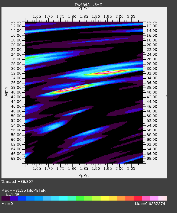
656A Willston, FL, USA - Earthquake Result Viewer
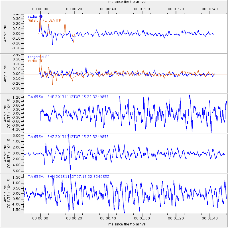
Earthquake location: Near East Coast Of Kamchatka
Earthquake latitude/longitude: 54.7/162.3
Earthquake time(UTC): 2013/11/12 (316) 07:03:51 GMT
Earthquake Depth: 43 km
Earthquake Magnitude: 6.4 MWW, 6.3 MWC, 6.4 MWW, 6.4 MWB, 6.5 MWC, 6.6 MI
Earthquake Catalog/Contributor: NEIC PDE/NEIC COMCAT
Network: TA USArray Transportable Network (new EarthScope stations)
Station: 656A Willston, FL, USA
Lat/Lon: 29.37 N/82.53 W
Elevation: 28 m
Distance: 79.5 deg
Az: 53.459 deg
Baz: 327.694 deg
Ray Param: 0.04882813
Estimated Moho Depth: 31.25 km
Estimated Crust Vp/Vs: 1.95
Assumed Crust Vp: 5.989 km/s
Estimated Crust Vs: 3.071 km/s
Estimated Crust Poisson's Ratio: 0.32
Radial Match: 86.807 %
Radial Bump: 375
Transverse Match: 74.51785 %
Transverse Bump: 400
SOD ConfigId: 626651
Insert Time: 2014-04-19 13:47:35.148 +0000
GWidth: 2.5
Max Bumps: 400
Tol: 0.001

Signal To Noise

ChannelStoNSTALTA
TA:656A: :BHZ:20131112T07:15:22.324985Z5.33357861.3470011E-62.5255108E-7
TA:656A: :BHN:20131112T07:15:22.324985Z1.2220373.6240445E-72.965577E-7
TA:656A: :BHE:20131112T07:15:22.324985Z1.68859224.6710863E-72.7662608E-7
Arrivals
Ps5.1 SECOND
PpPs15 SECOND
PsPs/PpSs20 SECOND