
L48A N Adams, MI, USA - Earthquake Result Viewer
| ||||||||||||||||||
| ||||||||||||||||||
| ||||||||||||||||||
|
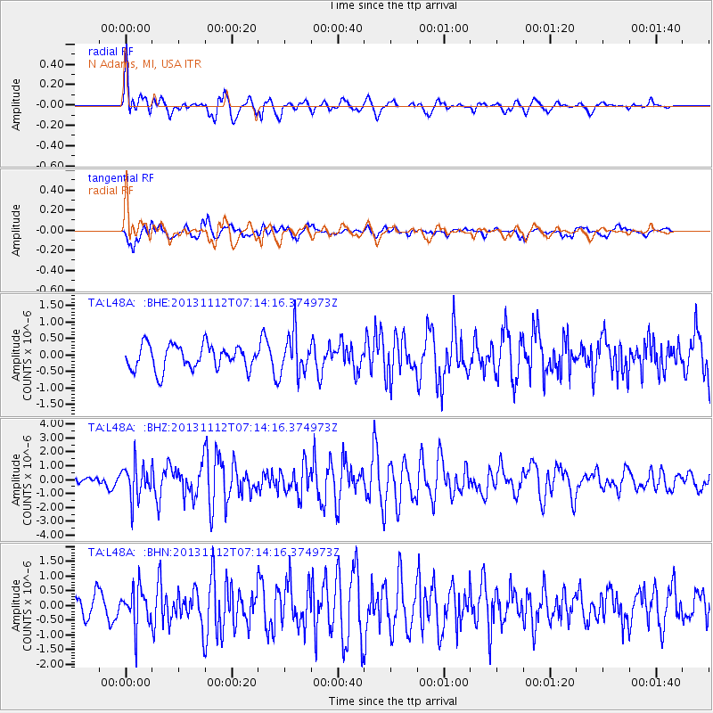
Signal To Noise
| Channel | StoN | STA | LTA |
| TA:L48A: :BHZ:20131112T07:14:16.374973Z | 2.4913046 | 1.2173824E-6 | 4.886526E-7 |
| TA:L48A: :BHN:20131112T07:14:16.374973Z | 1.7291204 | 6.438126E-7 | 3.7233534E-7 |
| TA:L48A: :BHE:20131112T07:14:16.374973Z | 1.6732203 | 6.185679E-7 | 3.696871E-7 |
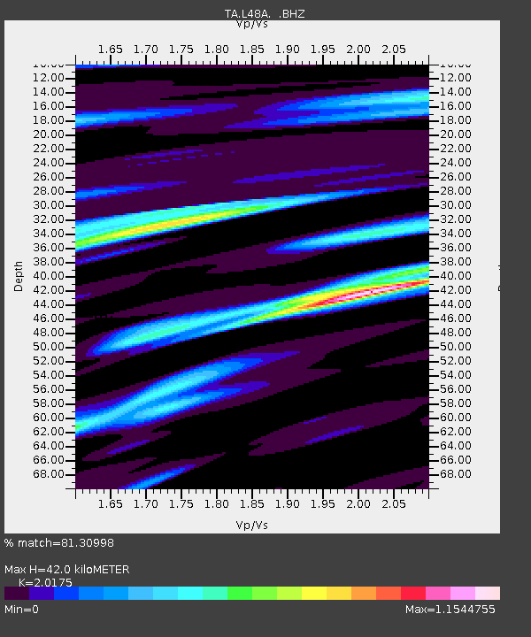
| Arrivals | |
| Ps | 6.8 SECOND |
| PpPs | 19 SECOND |
| PsPs/PpSs | 26 SECOND |

