N49A Columbus Grove, OH, USA - Earthquake Result Viewer
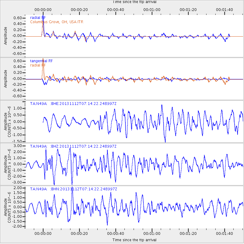
Earthquake location: Near East Coast Of Kamchatka
Earthquake latitude/longitude: 54.7/162.3
Earthquake time(UTC): 2013/11/12 (316) 07:03:51 GMT
Earthquake Depth: 43 km
Earthquake Magnitude: 6.4 MWW, 6.3 MWC, 6.4 MWW, 6.4 MWB, 6.5 MWC, 6.6 MI
Earthquake Catalog/Contributor: NEIC PDE/NEIC COMCAT
Network: TA USArray Transportable Network (new EarthScope stations)
Station: N49A Columbus Grove, OH, USA
Lat/Lon: 40.92 N/84.18 W
Elevation: 225 m
Distance: 69.2 deg
Az: 48.028 deg
Baz: 325.272 deg
Ray Param: 0.055749442
Estimated Moho Depth: 42.75 km
Estimated Crust Vp/Vs: 1.86
Assumed Crust Vp: 6.498 km/s
Estimated Crust Vs: 3.498 km/s
Estimated Crust Poisson's Ratio: 0.30
Radial Match: 87.084335 %
Radial Bump: 328
Transverse Match: 62.977367 %
Transverse Bump: 400
SOD ConfigId: 626651
Insert Time: 2014-04-19 13:53:40.704 +0000
GWidth: 2.5
Max Bumps: 400
Tol: 0.001

Signal To Noise

ChannelStoNSTALTA
TA:N49A: :BHZ:20131112T07:14:22.248997Z3.03601849.69963E-73.1948522E-7
TA:N49A: :BHN:20131112T07:14:22.248997Z1.64990894.6219344E-72.801327E-7
TA:N49A: :BHE:20131112T07:14:22.248997Z1.13989173.3263632E-72.9181396E-7
Arrivals
Ps5.9 SECOND
PpPs18 SECOND
PsPs/PpSs24 SECOND