O51A Pataskala, OH, USA - Earthquake Result Viewer
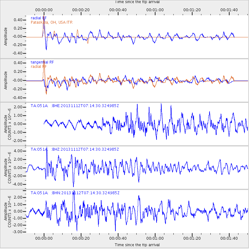
Earthquake location: Near East Coast Of Kamchatka
Earthquake latitude/longitude: 54.7/162.3
Earthquake time(UTC): 2013/11/12 (316) 07:03:51 GMT
Earthquake Depth: 43 km
Earthquake Magnitude: 6.4 MWW, 6.3 MWC, 6.4 MWW, 6.4 MWB, 6.5 MWC, 6.6 MI
Earthquake Catalog/Contributor: NEIC PDE/NEIC COMCAT
Network: TA USArray Transportable Network (new EarthScope stations)
Station: O51A Pataskala, OH, USA
Lat/Lon: 40.15 N/82.61 W
Elevation: 380 m
Distance: 70.5 deg
Az: 47.435 deg
Baz: 326.089 deg
Ray Param: 0.054876227
Estimated Moho Depth: 66.0 km
Estimated Crust Vp/Vs: 2.10
Assumed Crust Vp: 6.498 km/s
Estimated Crust Vs: 3.101 km/s
Estimated Crust Poisson's Ratio: 0.35
Radial Match: 80.29852 %
Radial Bump: 400
Transverse Match: 72.9519 %
Transverse Bump: 400
SOD ConfigId: 626651
Insert Time: 2014-04-19 13:54:19.106 +0000
GWidth: 2.5
Max Bumps: 400
Tol: 0.001

Signal To Noise

ChannelStoNSTALTA
TA:O51A: :BHZ:20131112T07:14:30.324985Z3.64291051.5199263E-64.1722856E-7
TA:O51A: :BHN:20131112T07:14:30.324985Z1.47705966.597734E-74.4668025E-7
TA:O51A: :BHE:20131112T07:14:30.324985Z1.31786053.7320865E-72.8319283E-7
Arrivals
Ps11 SECOND
PpPs30 SECOND
PsPs/PpSs42 SECOND