You are here: Home > Network List > IU - Global Seismograph Network (GSN - IRIS/USGS) Stations List
> Station RSSD Black Hills, South Dakota, USA > Earthquake Result Viewer
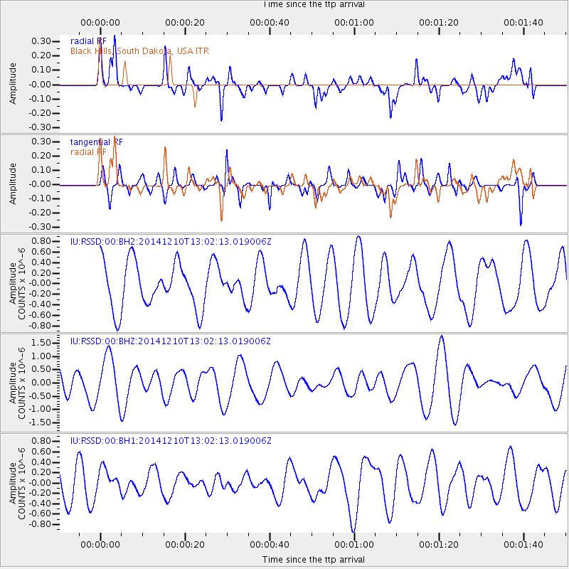
RSSD Black Hills, South Dakota, USA - Earthquake Result Viewer
*The percent match for this event was below the threshold and hence no stack was calculated.
| Earthquake location: |
Tonga Islands |
| Earthquake latitude/longitude: |
-18.5/-173.1 |
| Earthquake time(UTC): |
2014/12/10 (344) 12:49:51 GMT |
| Earthquake Depth: |
10 km |
| Earthquake Magnitude: |
5.0 MW, 5.0 mb |
| Earthquake Catalog/Contributor: |
ISC/ISC |
|
| Network: |
IU Global Seismograph Network (GSN - IRIS/USGS) |
| Station: |
RSSD Black Hills, South Dakota, USA |
| Lat/Lon: |
44.12 N/104.04 W |
| Elevation: |
2090 m |
|
| Distance: |
88.5 deg |
| Az: |
42.282 deg |
| Baz: |
242.437 deg |
| Ray Param: |
$rayparam |
*The percent match for this event was below the threshold and hence was not used in the summary stack. |
|
| Radial Match: |
48.341415 % |
| Radial Bump: |
400 |
| Transverse Match: |
68.669334 % |
| Transverse Bump: |
400 |
| SOD ConfigId: |
3390531 |
| Insert Time: |
2019-04-15 11:58:50.287 +0000 |
| GWidth: |
2.5 |
| Max Bumps: |
400 |
| Tol: |
0.001 |
|
Signal To Noise
| Channel | StoN | STA | LTA |
| IU:RSSD:00:BHZ:20141210T13:02:13.019006Z | 2.0000298 | 8.8936207E-7 | 4.446744E-7 |
| IU:RSSD:00:BH1:20141210T13:02:13.019006Z | 0.6788022 | 2.1893509E-7 | 3.2253152E-7 |
| IU:RSSD:00:BH2:20141210T13:02:13.019006Z | 0.41682553 | 1.808368E-7 | 4.338429E-7 |
| Arrivals |
| Ps | |
| PpPs | |
| PsPs/PpSs | |


