T54A Tazewell, VA, USA - Earthquake Result Viewer
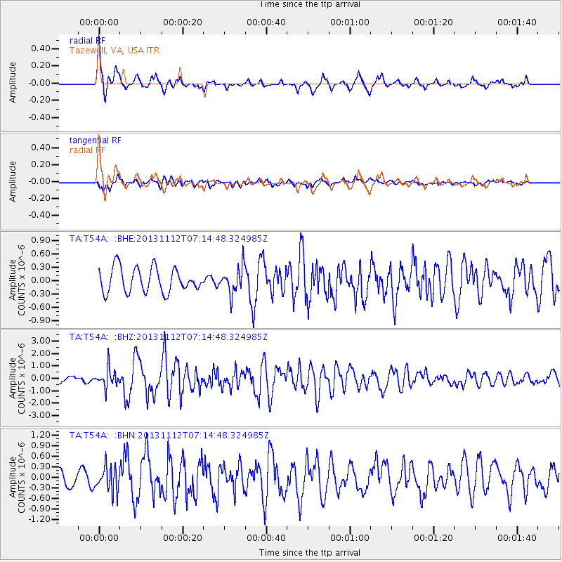
Earthquake location: Near East Coast Of Kamchatka
Earthquake latitude/longitude: 54.7/162.3
Earthquake time(UTC): 2013/11/12 (316) 07:03:51 GMT
Earthquake Depth: 43 km
Earthquake Magnitude: 6.4 MWW, 6.3 MWC, 6.4 MWW, 6.4 MWB, 6.5 MWC, 6.6 MI
Earthquake Catalog/Contributor: NEIC PDE/NEIC COMCAT
Network: TA USArray Transportable Network (new EarthScope stations)
Station: T54A Tazewell, VA, USA
Lat/Lon: 37.06 N/81.58 W
Elevation: 852 m
Distance: 73.5 deg
Az: 48.512 deg
Baz: 327.062 deg
Ray Param: 0.052889306
Estimated Moho Depth: 31.25 km
Estimated Crust Vp/Vs: 1.79
Assumed Crust Vp: 6.159 km/s
Estimated Crust Vs: 3.45 km/s
Estimated Crust Poisson's Ratio: 0.27
Radial Match: 80.29918 %
Radial Bump: 362
Transverse Match: 58.307858 %
Transverse Bump: 400
SOD ConfigId: 626651
Insert Time: 2014-04-19 13:57:02.933 +0000
GWidth: 2.5
Max Bumps: 400
Tol: 0.001

Signal To Noise

ChannelStoNSTALTA
TA:T54A: :BHZ:20131112T07:14:48.324985Z2.5703647.615652E-72.962869E-7
TA:T54A: :BHN:20131112T07:14:48.324985Z1.26862143.474428E-72.738743E-7
TA:T54A: :BHE:20131112T07:14:48.324985Z1.11471823.021808E-72.7108268E-7
Arrivals
Ps4.1 SECOND
PpPs14 SECOND
PsPs/PpSs18 SECOND