TPFO Pinon Flats, CA, USA - Earthquake Result Viewer
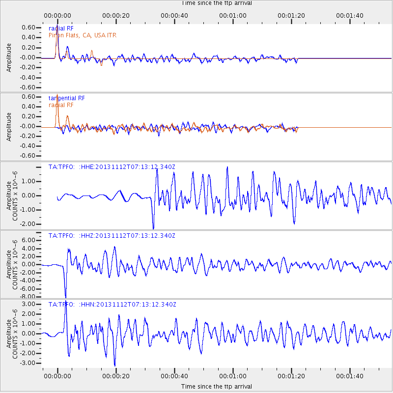
Earthquake location: Near East Coast Of Kamchatka
Earthquake latitude/longitude: 54.7/162.3
Earthquake time(UTC): 2013/11/12 (316) 07:03:51 GMT
Earthquake Depth: 43 km
Earthquake Magnitude: 6.4 MWW, 6.3 MWC, 6.4 MWW, 6.4 MWB, 6.5 MWC, 6.6 MI
Earthquake Catalog/Contributor: NEIC PDE/NEIC COMCAT
Network: TA USArray Transportable Network (new EarthScope stations)
Station: TPFO Pinon Flats, CA, USA
Lat/Lon: 33.61 N/116.45 W
Elevation: 1275 m
Distance: 58.5 deg
Az: 75.297 deg
Baz: 317.704 deg
Ray Param: 0.06270466
Estimated Moho Depth: 22.5 km
Estimated Crust Vp/Vs: 1.95
Assumed Crust Vp: 6.264 km/s
Estimated Crust Vs: 3.212 km/s
Estimated Crust Poisson's Ratio: 0.32
Radial Match: 91.164055 %
Radial Bump: 392
Transverse Match: 71.862854 %
Transverse Bump: 400
SOD ConfigId: 626651
Insert Time: 2014-04-19 13:57:24.698 +0000
GWidth: 2.5
Max Bumps: 400
Tol: 0.001

Signal To Noise

ChannelStoNSTALTA
TA:TPFO: :HHZ:20131112T07:13:12.340Z11.7896112.8628838E-62.4283108E-7
TA:TPFO: :HHN:20131112T07:13:12.340Z10.7718871.2665296E-61.17577315E-7
TA:TPFO: :HHE:20131112T07:13:12.340Z5.6087579.2587015E-71.6507582E-7
Arrivals
Ps3.6 SECOND
PpPs10 SECOND
PsPs/PpSs14 SECOND