
U59A Littleton, NC, USA - Earthquake Result Viewer
| ||||||||||||||||||
| ||||||||||||||||||
| ||||||||||||||||||
|
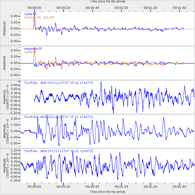
Signal To Noise
| Channel | StoN | STA | LTA |
| TA:U59A: :BHZ:20131112T07:15:01.124973Z | 3.6713793 | 7.493347E-7 | 2.0410167E-7 |
| TA:U59A: :BHN:20131112T07:15:01.124973Z | 1.6322486 | 3.2730216E-7 | 2.0052225E-7 |
| TA:U59A: :BHE:20131112T07:15:01.124973Z | 1.1115828 | 2.400889E-7 | 2.1598832E-7 |
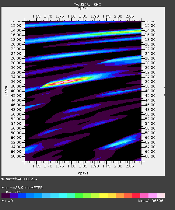
| Arrivals | |
| Ps | 4.3 SECOND |
| PpPs | 15 SECOND |
| PsPs/PpSs | 19 SECOND |

