V48A Smith Brothers Farm, Spring Hill, TN, USA - Earthquake Result Viewer
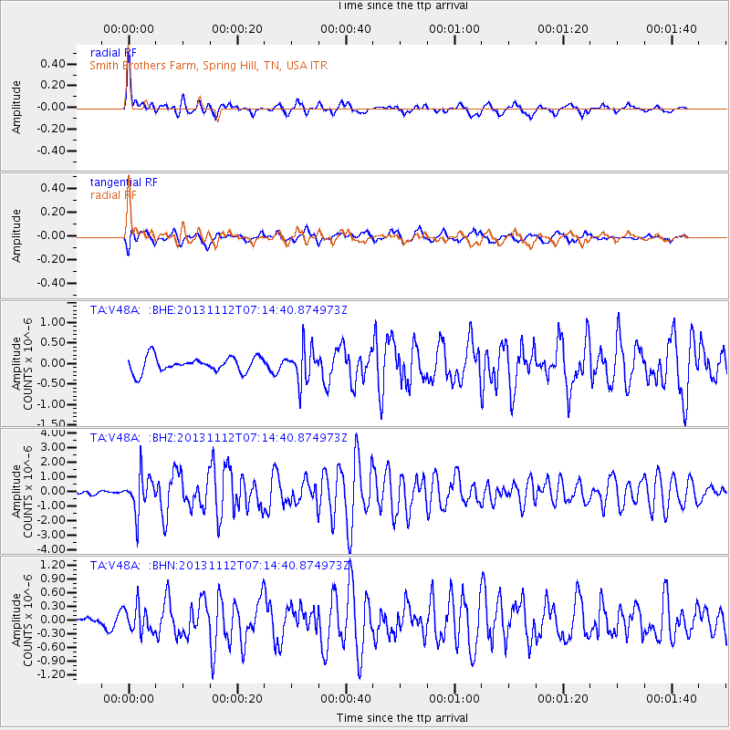
Earthquake location: Near East Coast Of Kamchatka
Earthquake latitude/longitude: 54.7/162.3
Earthquake time(UTC): 2013/11/12 (316) 07:03:51 GMT
Earthquake Depth: 43 km
Earthquake Magnitude: 6.4 MWW, 6.3 MWC, 6.4 MWW, 6.4 MWB, 6.5 MWC, 6.6 MI
Earthquake Catalog/Contributor: NEIC PDE/NEIC COMCAT
Network: TA USArray Transportable Network (new EarthScope stations)
Station: V48A Smith Brothers Farm, Spring Hill, TN, USA
Lat/Lon: 35.74 N/86.82 W
Elevation: 278 m
Distance: 72.2 deg
Az: 52.958 deg
Baz: 325.271 deg
Ray Param: 0.05371898
Estimated Moho Depth: 60.75 km
Estimated Crust Vp/Vs: 2.04
Assumed Crust Vp: 6.476 km/s
Estimated Crust Vs: 3.174 km/s
Estimated Crust Poisson's Ratio: 0.34
Radial Match: 84.00043 %
Radial Bump: 400
Transverse Match: 78.4315 %
Transverse Bump: 400
SOD ConfigId: 626651
Insert Time: 2014-04-19 13:58:07.097 +0000
GWidth: 2.5
Max Bumps: 400
Tol: 0.001

Signal To Noise

ChannelStoNSTALTA
TA:V48A: :BHZ:20131112T07:14:40.874973Z5.35992051.3028533E-62.4307326E-7
TA:V48A: :BHN:20131112T07:14:40.874973Z1.72277252.8471632E-71.6526636E-7
TA:V48A: :BHE:20131112T07:14:40.874973Z2.29268314.1660616E-71.817112E-7
Arrivals
Ps10 SECOND
PpPs28 SECOND
PsPs/PpSs38 SECOND