V57A Coltrane Farms, NC, USA - Earthquake Result Viewer
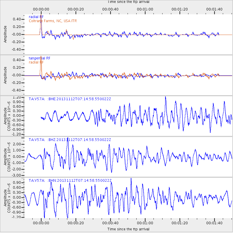
Earthquake location: Near East Coast Of Kamchatka
Earthquake latitude/longitude: 54.7/162.3
Earthquake time(UTC): 2013/11/12 (316) 07:03:51 GMT
Earthquake Depth: 43 km
Earthquake Magnitude: 6.4 MWW, 6.3 MWC, 6.4 MWW, 6.4 MWB, 6.5 MWC, 6.6 MI
Earthquake Catalog/Contributor: NEIC PDE/NEIC COMCAT
Network: TA USArray Transportable Network (new EarthScope stations)
Station: V57A Coltrane Farms, NC, USA
Lat/Lon: 35.89 N/79.78 W
Elevation: 223 m
Distance: 75.3 deg
Az: 47.894 deg
Baz: 327.961 deg
Ray Param: 0.051712085
Estimated Moho Depth: 35.5 km
Estimated Crust Vp/Vs: 1.60
Assumed Crust Vp: 6.565 km/s
Estimated Crust Vs: 4.103 km/s
Estimated Crust Poisson's Ratio: 0.18
Radial Match: 87.68611 %
Radial Bump: 385
Transverse Match: 62.95109 %
Transverse Bump: 400
SOD ConfigId: 626651
Insert Time: 2014-04-19 13:58:26.928 +0000
GWidth: 2.5
Max Bumps: 400
Tol: 0.001

Signal To Noise

ChannelStoNSTALTA
TA:V57A: :BHZ:20131112T07:14:58.550022Z2.35578877.114623E-73.0200596E-7
TA:V57A: :BHN:20131112T07:14:58.550022Z2.6540744.6139024E-71.7384228E-7
TA:V57A: :BHE:20131112T07:14:58.550022Z1.77007293.2495535E-71.8358303E-7
Arrivals
Ps3.4 SECOND
PpPs14 SECOND
PsPs/PpSs17 SECOND