You are here: Home > Network List > TA - USArray Transportable Network (new EarthScope stations) Stations List
> Station J01E Myrtle Point, OR, USA > Earthquake Result Viewer
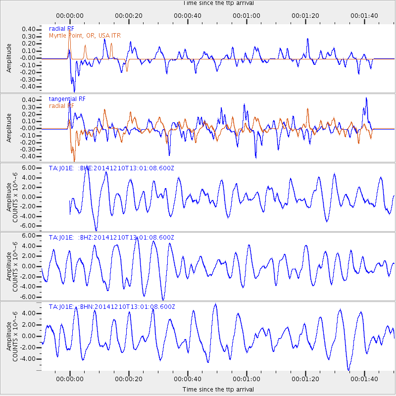
J01E Myrtle Point, OR, USA - Earthquake Result Viewer
*The percent match for this event was below the threshold and hence no stack was calculated.
| Earthquake location: |
Tonga Islands |
| Earthquake latitude/longitude: |
-18.5/-173.1 |
| Earthquake time(UTC): |
2014/12/10 (344) 12:49:51 GMT |
| Earthquake Depth: |
10 km |
| Earthquake Magnitude: |
5.0 MW, 5.0 mb |
| Earthquake Catalog/Contributor: |
ISC/ISC |
|
| Network: |
TA USArray Transportable Network (new EarthScope stations) |
| Station: |
J01E Myrtle Point, OR, USA |
| Lat/Lon: |
43.16 N/123.93 W |
| Elevation: |
128 m |
|
| Distance: |
76.2 deg |
| Az: |
34.752 deg |
| Baz: |
227.671 deg |
| Ray Param: |
$rayparam |
*The percent match for this event was below the threshold and hence was not used in the summary stack. |
|
| Radial Match: |
61.003265 % |
| Radial Bump: |
400 |
| Transverse Match: |
59.469296 % |
| Transverse Bump: |
400 |
| SOD ConfigId: |
3390531 |
| Insert Time: |
2019-04-15 12:00:36.564 +0000 |
| GWidth: |
2.5 |
| Max Bumps: |
400 |
| Tol: |
0.001 |
|
Signal To Noise
| Channel | StoN | STA | LTA |
| TA:J01E: :BHZ:20141210T13:01:08.600Z | 1.1348447 | 1.7405494E-6 | 1.5337336E-6 |
| TA:J01E: :BHN:20141210T13:01:08.600Z | 1.8824475 | 3.1253728E-6 | 1.660271E-6 |
| TA:J01E: :BHE:20141210T13:01:08.600Z | 0.64569753 | 1.9515094E-6 | 3.0223275E-6 |
| Arrivals |
| Ps | |
| PpPs | |
| PsPs/PpSs | |


