W50A Signal Mountain, TN, USA - Earthquake Result Viewer
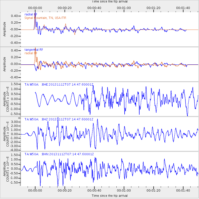
Earthquake location: Near East Coast Of Kamchatka
Earthquake latitude/longitude: 54.7/162.3
Earthquake time(UTC): 2013/11/12 (316) 07:03:51 GMT
Earthquake Depth: 43 km
Earthquake Magnitude: 6.4 MWW, 6.3 MWC, 6.4 MWW, 6.4 MWB, 6.5 MWC, 6.6 MI
Earthquake Catalog/Contributor: NEIC PDE/NEIC COMCAT
Network: TA USArray Transportable Network (new EarthScope stations)
Station: W50A Signal Mountain, TN, USA
Lat/Lon: 35.20 N/85.31 W
Elevation: 587 m
Distance: 73.4 deg
Az: 52.212 deg
Baz: 325.923 deg
Ray Param: 0.052970387
Estimated Moho Depth: 50.5 km
Estimated Crust Vp/Vs: 1.75
Assumed Crust Vp: 6.35 km/s
Estimated Crust Vs: 3.634 km/s
Estimated Crust Poisson's Ratio: 0.26
Radial Match: 80.35315 %
Radial Bump: 400
Transverse Match: 76.42735 %
Transverse Bump: 400
SOD ConfigId: 626651
Insert Time: 2014-04-19 13:58:50.837 +0000
GWidth: 2.5
Max Bumps: 400
Tol: 0.001

Signal To Noise

ChannelStoNSTALTA
TA:W50A: :BHZ:20131112T07:14:47.60001Z4.63052651.2706371E-62.7440444E-7
TA:W50A: :BHN:20131112T07:14:47.60001Z2.92287355.814187E-71.9892025E-7
TA:W50A: :BHE:20131112T07:14:47.60001Z1.19710274.0544538E-73.3868886E-7
Arrivals
Ps6.1 SECOND
PpPs21 SECOND
PsPs/PpSs27 SECOND