
W52A Murphy, NC, USA - Earthquake Result Viewer
| ||||||||||||||||||
| ||||||||||||||||||
| ||||||||||||||||||
|
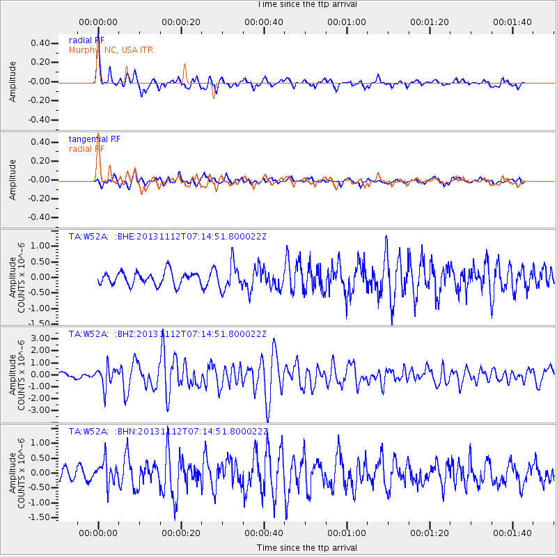
Signal To Noise
| Channel | StoN | STA | LTA |
| TA:W52A: :BHZ:20131112T07:14:51.800022Z | 3.305762 | 8.4783665E-7 | 2.5647236E-7 |
| TA:W52A: :BHN:20131112T07:14:51.800022Z | 2.7286227 | 3.9064892E-7 | 1.4316707E-7 |
| TA:W52A: :BHE:20131112T07:14:51.800022Z | 2.0748343 | 4.1920376E-7 | 2.0204203E-7 |
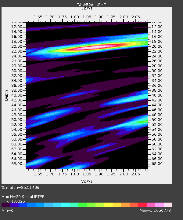
| Arrivals | |
| Ps | 2.9 SECOND |
| PpPs | 8.8 SECOND |
| PsPs/PpSs | 12 SECOND |

