W59A Clinton, NC, USA - Earthquake Result Viewer
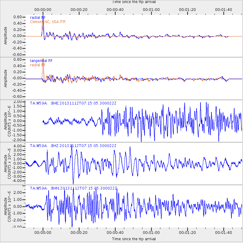
Earthquake location: Near East Coast Of Kamchatka
Earthquake latitude/longitude: 54.7/162.3
Earthquake time(UTC): 2013/11/12 (316) 07:03:51 GMT
Earthquake Depth: 43 km
Earthquake Magnitude: 6.4 MWW, 6.3 MWC, 6.4 MWW, 6.4 MWB, 6.5 MWC, 6.6 MI
Earthquake Catalog/Contributor: NEIC PDE/NEIC COMCAT
Network: TA USArray Transportable Network (new EarthScope stations)
Station: W59A Clinton, NC, USA
Lat/Lon: 35.17 N/78.44 W
Elevation: 60 m
Distance: 76.4 deg
Az: 47.33 deg
Baz: 328.594 deg
Ray Param: 0.050915375
Estimated Moho Depth: 38.25 km
Estimated Crust Vp/Vs: 1.64
Assumed Crust Vp: 6.565 km/s
Estimated Crust Vs: 3.991 km/s
Estimated Crust Poisson's Ratio: 0.21
Radial Match: 87.62762 %
Radial Bump: 400
Transverse Match: 66.054756 %
Transverse Bump: 400
SOD ConfigId: 626651
Insert Time: 2014-04-19 13:59:09.586 +0000
GWidth: 2.5
Max Bumps: 400
Tol: 0.001

Signal To Noise

ChannelStoNSTALTA
TA:W59A: :BHZ:20131112T07:15:05.300022Z4.79053641.1154873E-62.3285229E-7
TA:W59A: :BHN:20131112T07:15:05.300022Z5.01559351.0132007E-62.0201014E-7
TA:W59A: :BHE:20131112T07:15:05.300022Z2.96674755.3326636E-71.797478E-7
Arrivals
Ps3.9 SECOND
PpPs15 SECOND
PsPs/PpSs19 SECOND