
X48A Hartselle, AL, USA - Earthquake Result Viewer
| ||||||||||||||||||
| ||||||||||||||||||
| ||||||||||||||||||
|
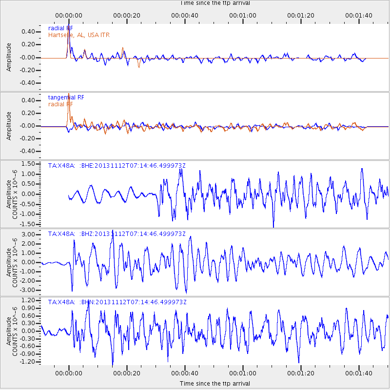
Signal To Noise
| Channel | StoN | STA | LTA |
| TA:X48A: :BHZ:20131112T07:14:46.499973Z | 8.277688 | 1.0765025E-6 | 1.3004869E-7 |
| TA:X48A: :BHN:20131112T07:14:46.499973Z | 2.3350122 | 3.4375415E-7 | 1.4721729E-7 |
| TA:X48A: :BHE:20131112T07:14:46.499973Z | 2.0694551 | 4.6527379E-7 | 2.2482911E-7 |
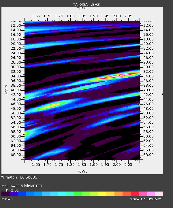
| Arrivals | |
| Ps | 5.4 SECOND |
| PpPs | 15 SECOND |
| PsPs/PpSs | 20 SECOND |

