X59A McDuffie Farm, Elizabethtown, NC, USA - Earthquake Result Viewer
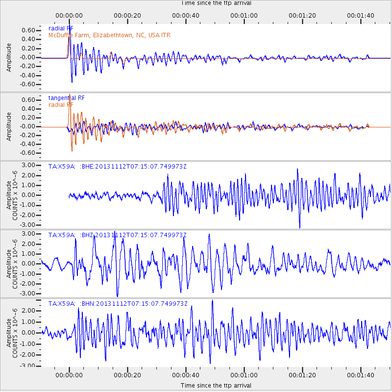
Earthquake location: Near East Coast Of Kamchatka
Earthquake latitude/longitude: 54.7/162.3
Earthquake time(UTC): 2013/11/12 (316) 07:03:51 GMT
Earthquake Depth: 43 km
Earthquake Magnitude: 6.4 MWW, 6.3 MWC, 6.4 MWW, 6.4 MWB, 6.5 MWC, 6.6 MI
Earthquake Catalog/Contributor: NEIC PDE/NEIC COMCAT
Network: TA USArray Transportable Network (new EarthScope stations)
Station: X59A McDuffie Farm, Elizabethtown, NC, USA
Lat/Lon: 34.57 N/78.60 W
Elevation: 29 m
Distance: 76.9 deg
Az: 47.763 deg
Baz: 328.603 deg
Ray Param: 0.050621275
Estimated Moho Depth: 36.0 km
Estimated Crust Vp/Vs: 1.74
Assumed Crust Vp: 6.565 km/s
Estimated Crust Vs: 3.767 km/s
Estimated Crust Poisson's Ratio: 0.25
Radial Match: 87.89461 %
Radial Bump: 400
Transverse Match: 72.55294 %
Transverse Bump: 400
SOD ConfigId: 626651
Insert Time: 2014-04-19 13:59:42.379 +0000
GWidth: 2.5
Max Bumps: 400
Tol: 0.001

Signal To Noise

ChannelStoNSTALTA
TA:X59A: :BHZ:20131112T07:15:07.749973Z2.92239888.2911305E-72.8370977E-7
TA:X59A: :BHN:20131112T07:15:07.749973Z3.10914091.0059348E-63.2354106E-7
TA:X59A: :BHE:20131112T07:15:07.749973Z4.2511098.338805E-71.9615598E-7
Arrivals
Ps4.2 SECOND
PpPs15 SECOND
PsPs/PpSs19 SECOND