X60A Albert Glenn Thornton, NC, USA - Earthquake Result Viewer
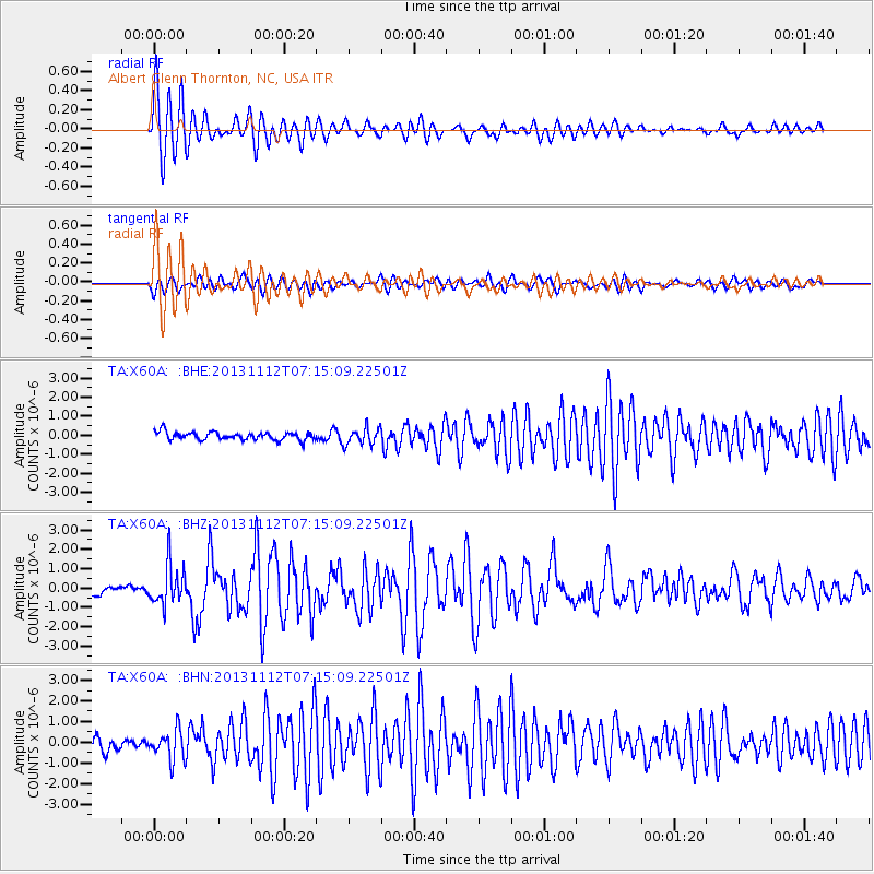
Earthquake location: Near East Coast Of Kamchatka
Earthquake latitude/longitude: 54.7/162.3
Earthquake time(UTC): 2013/11/12 (316) 07:03:51 GMT
Earthquake Depth: 43 km
Earthquake Magnitude: 6.4 MWW, 6.3 MWC, 6.4 MWW, 6.4 MWB, 6.5 MWC, 6.6 MI
Earthquake Catalog/Contributor: NEIC PDE/NEIC COMCAT
Network: TA USArray Transportable Network (new EarthScope stations)
Station: X60A Albert Glenn Thornton, NC, USA
Lat/Lon: 34.58 N/77.98 W
Elevation: 12 m
Distance: 77.1 deg
Az: 47.307 deg
Baz: 328.854 deg
Ray Param: 0.050445646
Estimated Moho Depth: 36.5 km
Estimated Crust Vp/Vs: 1.74
Assumed Crust Vp: 6.565 km/s
Estimated Crust Vs: 3.767 km/s
Estimated Crust Poisson's Ratio: 0.25
Radial Match: 94.495155 %
Radial Bump: 400
Transverse Match: 78.381096 %
Transverse Bump: 400
SOD ConfigId: 626651
Insert Time: 2014-04-19 13:59:44.613 +0000
GWidth: 2.5
Max Bumps: 400
Tol: 0.001

Signal To Noise

ChannelStoNSTALTA
TA:X60A: :BHZ:20131112T07:15:09.22501Z4.0594161.064364E-62.6219638E-7
TA:X60A: :BHN:20131112T07:15:09.22501Z2.30948837.1216203E-73.0836358E-7
TA:X60A: :BHE:20131112T07:15:09.22501Z2.19956564.5655216E-72.0756468E-7
Arrivals
Ps4.3 SECOND
PpPs15 SECOND
PsPs/PpSs19 SECOND