You are here: Home > Network List > UW - Pacific Northwest Regional Seismic Network Stations List
> Station UMAT Pilot Rock, OR, USA > Earthquake Result Viewer
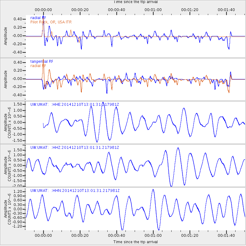
UMAT Pilot Rock, OR, USA - Earthquake Result Viewer
*The percent match for this event was below the threshold and hence no stack was calculated.
| Earthquake location: |
Tonga Islands |
| Earthquake latitude/longitude: |
-18.5/-173.1 |
| Earthquake time(UTC): |
2014/12/10 (344) 12:49:51 GMT |
| Earthquake Depth: |
10 km |
| Earthquake Magnitude: |
5.0 MW, 5.0 mb |
| Earthquake Catalog/Contributor: |
ISC/ISC |
|
| Network: |
UW Pacific Northwest Regional Seismic Network |
| Station: |
UMAT Pilot Rock, OR, USA |
| Lat/Lon: |
45.29 N/118.96 W |
| Elevation: |
1318 m |
|
| Distance: |
80.3 deg |
| Az: |
35.472 deg |
| Baz: |
231.276 deg |
| Ray Param: |
$rayparam |
*The percent match for this event was below the threshold and hence was not used in the summary stack. |
|
| Radial Match: |
42.366024 % |
| Radial Bump: |
400 |
| Transverse Match: |
46.92513 % |
| Transverse Bump: |
400 |
| SOD ConfigId: |
3390531 |
| Insert Time: |
2019-04-15 12:01:33.111 +0000 |
| GWidth: |
2.5 |
| Max Bumps: |
400 |
| Tol: |
0.001 |
|
Signal To Noise
| Channel | StoN | STA | LTA |
| UW:UMAT: :HHZ:20141210T13:01:31.217981Z | 0.83775127 | 6.090506E-7 | 7.270064E-7 |
| UW:UMAT: :HHN:20141210T13:01:31.217981Z | 1.7923086 | 5.99191E-7 | 3.3431243E-7 |
| UW:UMAT: :HHE:20141210T13:01:31.217981Z | 2.9212143 | 1.1970428E-6 | 4.0977574E-7 |
| Arrivals |
| Ps | |
| PpPs | |
| PsPs/PpSs | |


