Y12C Blythe, CA, USA - Earthquake Result Viewer
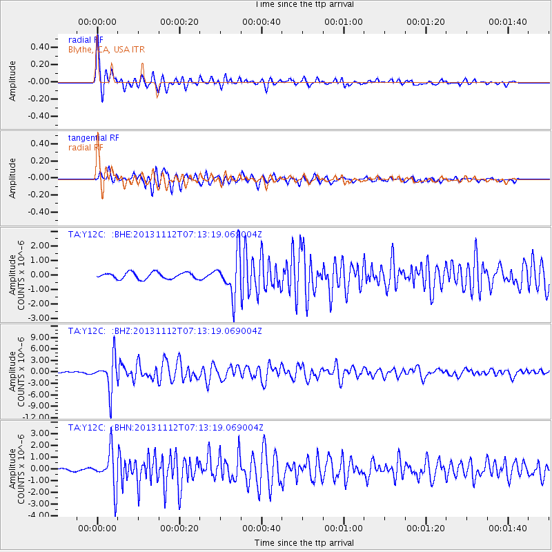
Earthquake location: Near East Coast Of Kamchatka
Earthquake latitude/longitude: 54.7/162.3
Earthquake time(UTC): 2013/11/12 (316) 07:03:51 GMT
Earthquake Depth: 43 km
Earthquake Magnitude: 6.4 MWW, 6.3 MWC, 6.4 MWW, 6.4 MWB, 6.5 MWC, 6.6 MI
Earthquake Catalog/Contributor: NEIC PDE/NEIC COMCAT
Network: TA USArray Transportable Network (new EarthScope stations)
Station: Y12C Blythe, CA, USA
Lat/Lon: 33.75 N/114.52 W
Elevation: 196 m
Distance: 59.5 deg
Az: 73.792 deg
Baz: 317.995 deg
Ray Param: 0.062065184
Estimated Moho Depth: 33.5 km
Estimated Crust Vp/Vs: 1.61
Assumed Crust Vp: 6.155 km/s
Estimated Crust Vs: 3.823 km/s
Estimated Crust Poisson's Ratio: 0.19
Radial Match: 93.83451 %
Radial Bump: 370
Transverse Match: 88.70566 %
Transverse Bump: 400
SOD ConfigId: 626651
Insert Time: 2014-04-19 13:59:46.529 +0000
GWidth: 2.5
Max Bumps: 400
Tol: 0.001

Signal To Noise

ChannelStoNSTALTA
TA:Y12C: :BHZ:20131112T07:13:19.069004Z11.1682264.35367E-63.8982648E-7
TA:Y12C: :BHN:20131112T07:13:19.069004Z11.180271.621343E-61.4501823E-7
TA:Y12C: :BHE:20131112T07:13:19.069004Z6.77116251.4804956E-62.1864719E-7
Arrivals
Ps3.5 SECOND
PpPs14 SECOND
PsPs/PpSs17 SECOND