
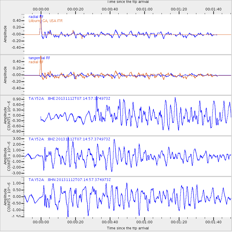
Y52A Lilburn, GA, USA - Earthquake Result Viewer
| ||||||||||||||||||
| ||||||||||||||||||
| ||||||||||||||||||
|
Signal To Noise
| Channel | StoN | STA | LTA |
| TA:Y52A: :BHZ:20131112T07:14:57.374973Z | 4.6182003 | 7.712891E-7 | 1.6701075E-7 |
| TA:Y52A: :BHN:20131112T07:14:57.374973Z | 3.117431 | 4.1929033E-7 | 1.3449868E-7 |
| TA:Y52A: :BHE:20131112T07:14:57.374973Z | 2.613345 | 3.907565E-7 | 1.4952352E-7 |
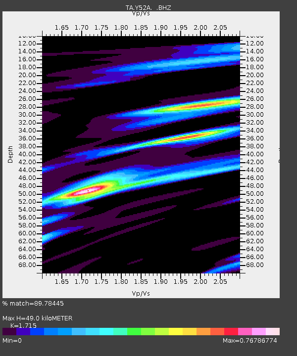
| Arrivals | |
| Ps | 5.4 SECOND |
| PpPs | 19 SECOND |
| PsPs/PpSs | 24 SECOND |

