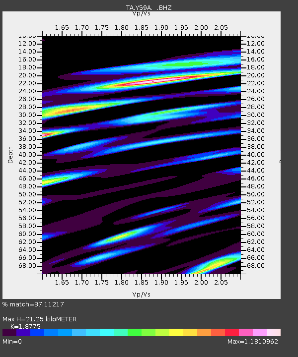
Y59A Loris, SC, USA - Earthquake Result Viewer
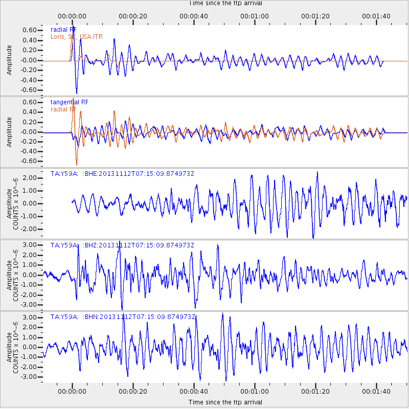
Earthquake location: Near East Coast Of Kamchatka
Earthquake latitude/longitude: 54.7/162.3
Earthquake time(UTC): 2013/11/12 (316) 07:03:51 GMT
Earthquake Depth: 43 km
Earthquake Magnitude: 6.4 MWW, 6.3 MWC, 6.4 MWW, 6.4 MWB, 6.5 MWC, 6.6 MI
Earthquake Catalog/Contributor: NEIC PDE/NEIC COMCAT
Network: TA USArray Transportable Network (new EarthScope stations)
Station: Y59A Loris, SC, USA
Lat/Lon: 33.99 N/78.87 W
Elevation: 2.0 m
Distance: 77.3 deg
Az: 48.27 deg
Baz: 328.565 deg
Ray Param: 0.050367884
Estimated Moho Depth: 21.25 km
Estimated Crust Vp/Vs: 1.88
Assumed Crust Vp: 6.24 km/s
Estimated Crust Vs: 3.324 km/s
Estimated Crust Poisson's Ratio: 0.30
Radial Match: 87.11217 %
Radial Bump: 385
Transverse Match: 77.01896 %
Transverse Bump: 400
SOD ConfigId: 626651
Insert Time: 2014-04-19 14:00:13.102 +0000
GWidth: 2.5
Max Bumps: 400
Tol: 0.001

Signal To Noise

ChannelStoNSTALTA
TA:Y59A: :BHZ:20131112T07:15:09.874973Z6.4269181.0798339E-61.6801738E-7
TA:Y59A: :BHN:20131112T07:15:09.874973Z1.643137.839411E-74.7710233E-7
TA:Y59A: :BHE:20131112T07:15:09.874973Z1.36499825.413473E-73.9659196E-7
Arrivals
Ps3.1 SECOND
PpPs9.5 SECOND
PsPs/PpSs13 SECOND