
SHAA Shaartuz, Tajikistan - Earthquake Result Viewer
| ||||||||||||||||||
| ||||||||||||||||||
| ||||||||||||||||||
|
Signal To Noise
| Channel | StoN | STA | LTA |
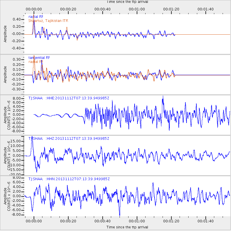
| TJ:SHAA: :HHZ:20131112T07:13:39.949985Z | 39.8288 | 9.782769E-6 | 2.4562047E-7 |
| TJ:SHAA: :HHN:20131112T07:13:39.949985Z | 10.843881 | 3.201184E-6 | 2.9520652E-7 |
| TJ:SHAA: :HHE:20131112T07:13:39.949985Z | 4.910751 | 2.397009E-6 | 4.8811455E-7 |
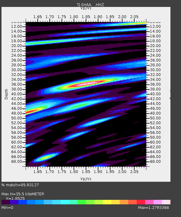
| Arrivals | |
| Ps | 5.1 SECOND |
| PpPs | 16 SECOND |
| PsPs/PpSs | 21 SECOND |

