You are here: Home > Network List > US - United States National Seismic Network Stations List
> Station HAWA Hanford, Washington, USA > Earthquake Result Viewer
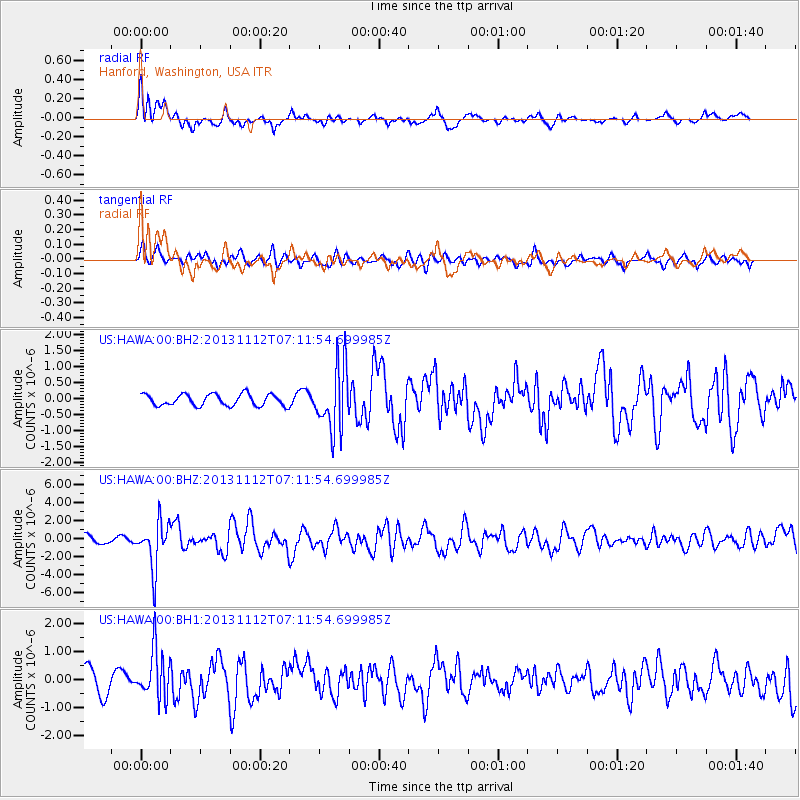
HAWA Hanford, Washington, USA - Earthquake Result Viewer
*The percent match for this event was below the threshold and hence no stack was calculated.
| Earthquake location: |
Near East Coast Of Kamchatka |
| Earthquake latitude/longitude: |
54.7/162.3 |
| Earthquake time(UTC): |
2013/11/12 (316) 07:03:51 GMT |
| Earthquake Depth: |
43 km |
| Earthquake Magnitude: |
6.4 MWW, 6.3 MWC, 6.4 MWW, 6.4 MWB, 6.5 MWC, 6.6 MI |
| Earthquake Catalog/Contributor: |
NEIC PDE/NEIC COMCAT |
|
| Network: |
US United States National Seismic Network |
| Station: |
HAWA Hanford, Washington, USA |
| Lat/Lon: |
46.39 N/119.53 W |
| Elevation: |
364 m |
|
| Distance: |
47.9 deg |
| Az: |
65.866 deg |
| Baz: |
310.041 deg |
| Ray Param: |
$rayparam |
*The percent match for this event was below the threshold and hence was not used in the summary stack. |
|
| Radial Match: |
73.290184 % |
| Radial Bump: |
400 |
| Transverse Match: |
64.990715 % |
| Transverse Bump: |
400 |
| SOD ConfigId: |
626651 |
| Insert Time: |
2014-04-19 14:02:21.438 +0000 |
| GWidth: |
2.5 |
| Max Bumps: |
400 |
| Tol: |
0.001 |
|
Signal To Noise
| Channel | StoN | STA | LTA |
| US:HAWA:00:BHZ:20131112T07:11:54.699985Z | 5.0263166 | 2.5822537E-6 | 5.1374667E-7 |
| US:HAWA:00:BH1:20131112T07:11:54.699985Z | 2.6162124 | 8.779675E-7 | 3.3558726E-7 |
| US:HAWA:00:BH2:20131112T07:11:54.699985Z | 5.5395923 | 9.989125E-7 | 1.8032237E-7 |
| Arrivals |
| Ps | |
| PpPs | |
| PsPs/PpSs | |


