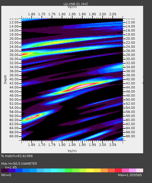
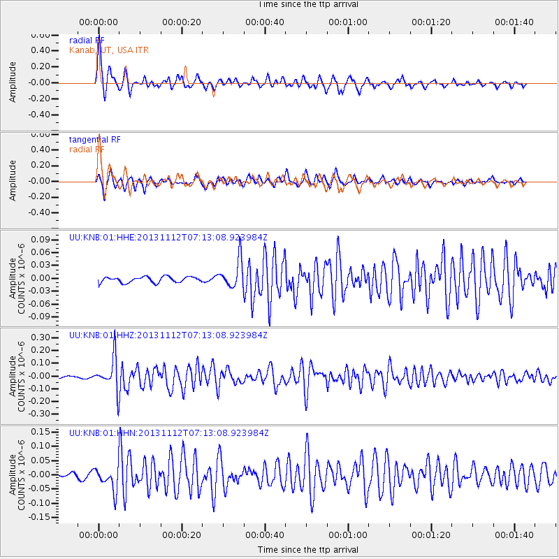
KNB Kanab, UT, USA - Earthquake Result Viewer

Earthquake location: Near East Coast Of Kamchatka
Earthquake latitude/longitude: 54.7/162.3
Earthquake time(UTC): 2013/11/12 (316) 07:03:51 GMT
Earthquake Depth: 43 km
Earthquake Magnitude: 6.4 MWW, 6.3 MWC, 6.4 MWW, 6.4 MWB, 6.5 MWC, 6.6 MI
Earthquake Catalog/Contributor: NEIC PDE/NEIC COMCAT
Network: UU University of Utah Regional Network
Station: KNB Kanab, UT, USA
Lat/Lon: 37.02 N/112.82 W
Elevation: 1715 m
Distance: 58.0 deg
Az: 70.018 deg
Baz: 317.018 deg
Ray Param: 0.06302369
Estimated Moho Depth: 58.5 km
Estimated Crust Vp/Vs: 1.65
Assumed Crust Vp: 6.194 km/s
Estimated Crust Vs: 3.754 km/s
Estimated Crust Poisson's Ratio: 0.21
Radial Match: 92.61896 %
Radial Bump: 367
Transverse Match: 84.77677 %
Transverse Bump: 400
SOD ConfigId: 626651
Insert Time: 2014-04-19 14:03:55.094 +0000
GWidth: 2.5
Max Bumps: 400
Tol: 0.001

Signal To Noise

ChannelStoNSTALTA
UU:KNB:01:HHZ:20131112T07:13:08.923984Z15.3619781.3125234E-78.543974E-9
UU:KNB:01:HHN:20131112T07:13:08.923984Z4.67800474.201055E-88.980442E-9
UU:KNB:01:HHE:20131112T07:13:08.923984Z5.1134853.403907E-86.6567263E-9
Arrivals
Ps6.4 SECOND
PpPs24 SECOND
PsPs/PpSs30 SECOND