You are here: Home > Network List > UW - Pacific Northwest Regional Seismic Network Stations List
> Station LON Longmire CREST broad-band > Earthquake Result Viewer
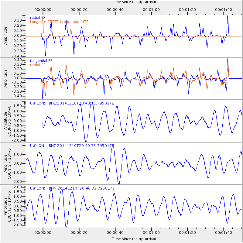
LON Longmire CREST broad-band - Earthquake Result Viewer
*The percent match for this event was below the threshold and hence no stack was calculated.
| Earthquake location: |
Philippine Islands Region |
| Earthquake latitude/longitude: |
19.1/121.2 |
| Earthquake time(UTC): |
2014/12/10 (344) 20:27:54 GMT |
| Earthquake Depth: |
46 km |
| Earthquake Magnitude: |
5.2 MW, 5.0 mb |
| Earthquake Catalog/Contributor: |
ISC/ISC |
|
| Network: |
UW Pacific Northwest Regional Seismic Network |
| Station: |
LON Longmire CREST broad-band |
| Lat/Lon: |
46.75 N/121.81 W |
| Elevation: |
853 m |
|
| Distance: |
93.4 deg |
| Az: |
37.852 deg |
| Baz: |
302.464 deg |
| Ray Param: |
$rayparam |
*The percent match for this event was below the threshold and hence was not used in the summary stack. |
|
| Radial Match: |
64.256485 % |
| Radial Bump: |
279 |
| Transverse Match: |
55.652447 % |
| Transverse Bump: |
348 |
| SOD ConfigId: |
3390531 |
| Insert Time: |
2019-04-15 12:10:31.097 +0000 |
| GWidth: |
2.5 |
| Max Bumps: |
400 |
| Tol: |
0.001 |
|
Signal To Noise
| Channel | StoN | STA | LTA |
| UW:LON: :BHZ:20141210T20:40:33.795017Z | 1.3824224 | 9.4155695E-7 | 6.8109205E-7 |
| UW:LON: :BHN:20141210T20:40:33.795017Z | 1.5801595 | 1.2073215E-6 | 7.6405036E-7 |
| UW:LON: :BHE:20141210T20:40:33.795017Z | 1.309392 | 1.0220718E-6 | 7.8056974E-7 |
| Arrivals |
| Ps | |
| PpPs | |
| PsPs/PpSs | |


