You are here: Home > Network List > TA - USArray Transportable Network (new EarthScope stations) Stations List
> Station O52A Adamsville, OH, USA > Earthquake Result Viewer
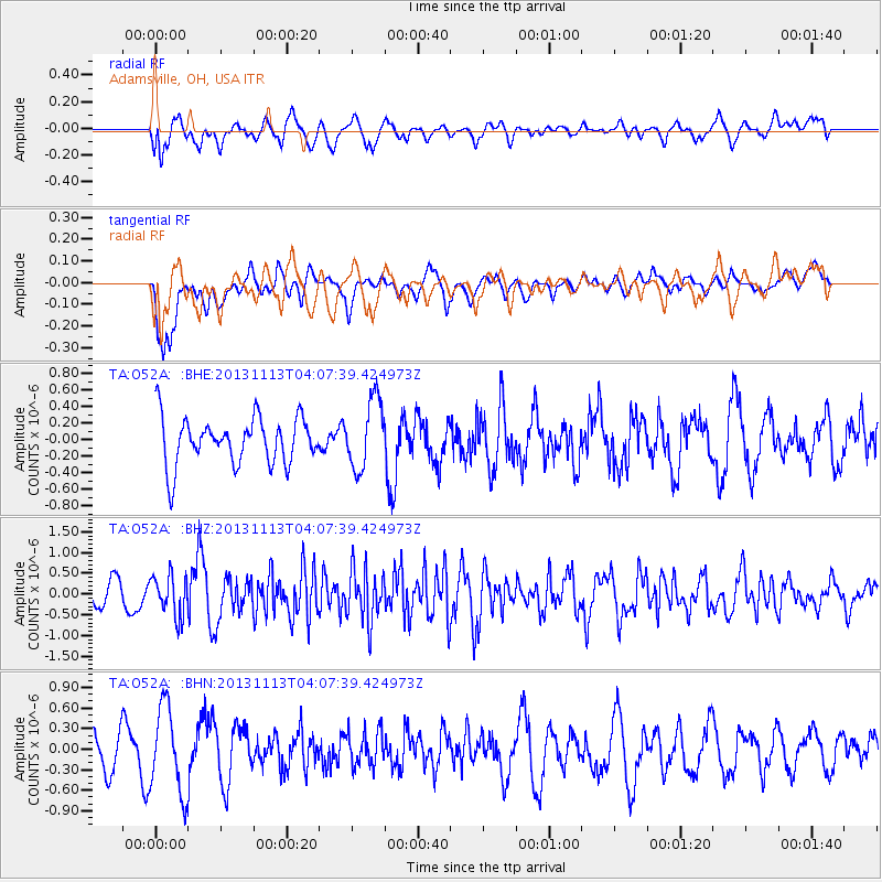
O52A Adamsville, OH, USA - Earthquake Result Viewer
*The percent match for this event was below the threshold and hence no stack was calculated.
| Earthquake location: |
Andreanof Islands, Aleutian Is. |
| Earthquake latitude/longitude: |
51.5/-179.0 |
| Earthquake time(UTC): |
2013/11/13 (317) 03:57:39 GMT |
| Earthquake Depth: |
20 km |
| Earthquake Magnitude: |
5.8 MWW, 5.6 MWB, 5.7 MI, 5.8 MWW, 5.9 MWC, 6.0 ML |
| Earthquake Catalog/Contributor: |
NEIC PDE/NEIC COMCAT |
|
| Network: |
TA USArray Transportable Network (new EarthScope stations) |
| Station: |
O52A Adamsville, OH, USA |
| Lat/Lon: |
40.12 N/81.84 W |
| Elevation: |
331 m |
|
| Distance: |
63.8 deg |
| Az: |
58.001 deg |
| Baz: |
316.328 deg |
| Ray Param: |
$rayparam |
*The percent match for this event was below the threshold and hence was not used in the summary stack. |
|
| Radial Match: |
40.205032 % |
| Radial Bump: |
400 |
| Transverse Match: |
75.18971 % |
| Transverse Bump: |
400 |
| SOD ConfigId: |
626651 |
| Insert Time: |
2014-04-19 14:34:51.414 +0000 |
| GWidth: |
2.5 |
| Max Bumps: |
400 |
| Tol: |
0.001 |
|
Signal To Noise
| Channel | StoN | STA | LTA |
| TA:O52A: :BHZ:20131113T04:07:39.424973Z | 1.8107852 | 4.93283E-7 | 2.7241387E-7 |
| TA:O52A: :BHN:20131113T04:07:39.424973Z | 1.7558686 | 6.3153107E-7 | 3.5966877E-7 |
| TA:O52A: :BHE:20131113T04:07:39.424973Z | 1.4933292 | 4.217182E-7 | 2.8240137E-7 |
| Arrivals |
| Ps | |
| PpPs | |
| PsPs/PpSs | |


