You are here: Home > Network List > TA - USArray Transportable Network (new EarthScope stations) Stations List
> Station Z41A Richland Creek Farm, El Dorado, AR, USA > Earthquake Result Viewer
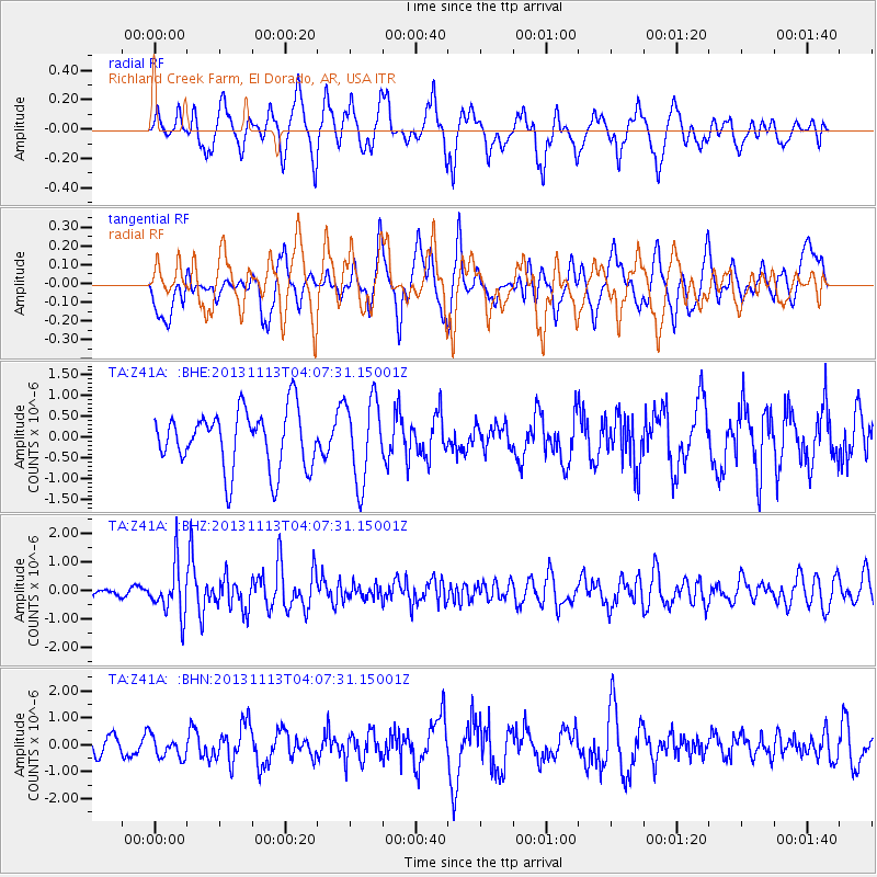
Z41A Richland Creek Farm, El Dorado, AR, USA - Earthquake Result Viewer
*The percent match for this event was below the threshold and hence no stack was calculated.
| Earthquake location: |
Andreanof Islands, Aleutian Is. |
| Earthquake latitude/longitude: |
51.5/-179.0 |
| Earthquake time(UTC): |
2013/11/13 (317) 03:57:39 GMT |
| Earthquake Depth: |
20 km |
| Earthquake Magnitude: |
5.8 MWW, 5.6 MWB, 5.7 MI, 5.8 MWW, 5.9 MWC, 6.0 ML |
| Earthquake Catalog/Contributor: |
NEIC PDE/NEIC COMCAT |
|
| Network: |
TA USArray Transportable Network (new EarthScope stations) |
| Station: |
Z41A Richland Creek Farm, El Dorado, AR, USA |
| Lat/Lon: |
33.26 N/92.80 W |
| Elevation: |
62 m |
|
| Distance: |
62.5 deg |
| Az: |
70.418 deg |
| Baz: |
315.402 deg |
| Ray Param: |
$rayparam |
*The percent match for this event was below the threshold and hence was not used in the summary stack. |
|
| Radial Match: |
57.052776 % |
| Radial Bump: |
400 |
| Transverse Match: |
49.49364 % |
| Transverse Bump: |
400 |
| SOD ConfigId: |
626651 |
| Insert Time: |
2014-04-19 14:39:01.175 +0000 |
| GWidth: |
2.5 |
| Max Bumps: |
400 |
| Tol: |
0.001 |
|
Signal To Noise
| Channel | StoN | STA | LTA |
| TA:Z41A: :BHZ:20131113T04:07:31.15001Z | 5.0759735 | 8.661495E-7 | 1.7063712E-7 |
| TA:Z41A: :BHN:20131113T04:07:31.15001Z | 1.050954 | 4.1066957E-7 | 3.9075883E-7 |
| TA:Z41A: :BHE:20131113T04:07:31.15001Z | 1.414706 | 9.788984E-7 | 6.919447E-7 |
| Arrivals |
| Ps | |
| PpPs | |
| PsPs/PpSs | |


