You are here: Home > Network List > BK - Berkeley Digital Seismograph Network Stations List
> Station HUMO Hull Mountain, OR > Earthquake Result Viewer
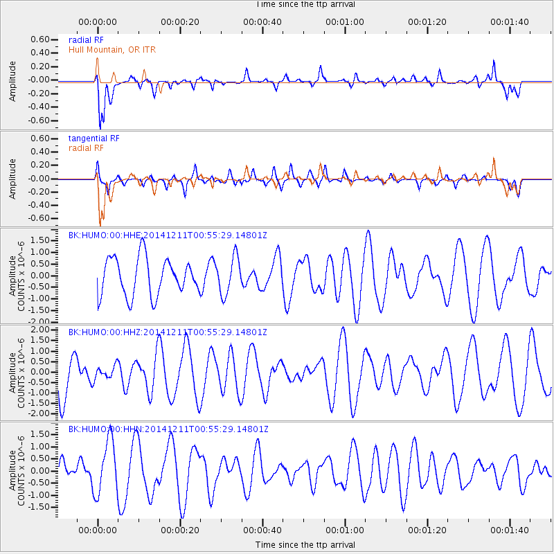
HUMO Hull Mountain, OR - Earthquake Result Viewer
*The percent match for this event was below the threshold and hence no stack was calculated.
| Earthquake location: |
W. Caroline Islands, Micronesia |
| Earthquake latitude/longitude: |
11.6/141.5 |
| Earthquake time(UTC): |
2014/12/11 (345) 00:43:22 GMT |
| Earthquake Depth: |
35 km |
| Earthquake Magnitude: |
5.1 mb |
| Earthquake Catalog/Contributor: |
ISC/ISC |
|
| Network: |
BK Berkeley Digital Seismograph Network |
| Station: |
HUMO Hull Mountain, OR |
| Lat/Lon: |
42.61 N/122.96 W |
| Elevation: |
555 m |
|
| Distance: |
86.3 deg |
| Az: |
47.417 deg |
| Baz: |
282.237 deg |
| Ray Param: |
$rayparam |
*The percent match for this event was below the threshold and hence was not used in the summary stack. |
|
| Radial Match: |
67.5625 % |
| Radial Bump: |
400 |
| Transverse Match: |
61.51923 % |
| Transverse Bump: |
400 |
| SOD ConfigId: |
3390531 |
| Insert Time: |
2019-04-15 12:23:56.013 +0000 |
| GWidth: |
2.5 |
| Max Bumps: |
400 |
| Tol: |
0.001 |
|
Signal To Noise
| Channel | StoN | STA | LTA |
| BK:HUMO:00:HHZ:20141211T00:55:29.14801Z | 0.22811449 | 3.0228188E-7 | 1.3251322E-6 |
| BK:HUMO:00:HHN:20141211T00:55:29.14801Z | 2.3831303 | 1.1206997E-6 | 4.7026376E-7 |
| BK:HUMO:00:HHE:20141211T00:55:29.14801Z | 1.0063089 | 8.059317E-7 | 8.0087904E-7 |
| Arrivals |
| Ps | |
| PpPs | |
| PsPs/PpSs | |


