You are here: Home > Network List > CI - Caltech Regional Seismic Network Stations List
> Station MPP McPhearson Peak > Earthquake Result Viewer
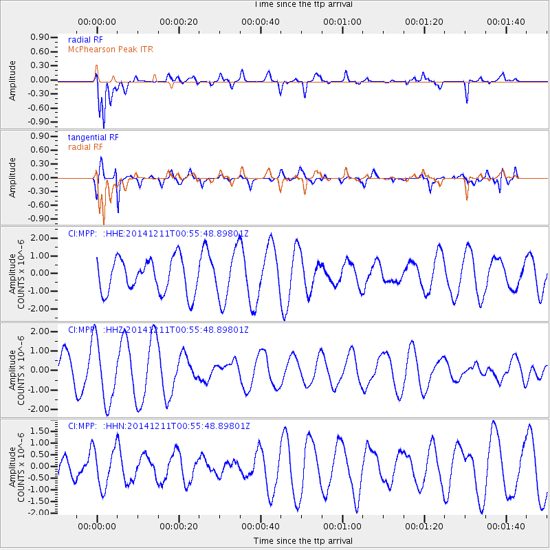
MPP McPhearson Peak - Earthquake Result Viewer
*The percent match for this event was below the threshold and hence no stack was calculated.
| Earthquake location: |
W. Caroline Islands, Micronesia |
| Earthquake latitude/longitude: |
11.6/141.5 |
| Earthquake time(UTC): |
2014/12/11 (345) 00:43:22 GMT |
| Earthquake Depth: |
35 km |
| Earthquake Magnitude: |
5.1 mb |
| Earthquake Catalog/Contributor: |
ISC/ISC |
|
| Network: |
CI Caltech Regional Seismic Network |
| Station: |
MPP McPhearson Peak |
| Lat/Lon: |
34.89 N/119.81 W |
| Elevation: |
1739 m |
|
| Distance: |
90.5 deg |
| Az: |
54.35 deg |
| Baz: |
284.394 deg |
| Ray Param: |
$rayparam |
*The percent match for this event was below the threshold and hence was not used in the summary stack. |
|
| Radial Match: |
77.221344 % |
| Radial Bump: |
400 |
| Transverse Match: |
79.78542 % |
| Transverse Bump: |
400 |
| SOD ConfigId: |
3390531 |
| Insert Time: |
2019-04-15 12:24:20.520 +0000 |
| GWidth: |
2.5 |
| Max Bumps: |
400 |
| Tol: |
0.001 |
|
Signal To Noise
| Channel | StoN | STA | LTA |
| CI:MPP: :HHZ:20141211T00:55:48.89801Z | 2.4718487 | 1.6102396E-6 | 6.5143126E-7 |
| CI:MPP: :HHN:20141211T00:55:48.89801Z | 1.9787297 | 8.3883884E-7 | 4.2392796E-7 |
| CI:MPP: :HHE:20141211T00:55:48.89801Z | 1.5247866 | 1.4545541E-6 | 9.539394E-7 |
| Arrivals |
| Ps | |
| PpPs | |
| PsPs/PpSs | |


