You are here: Home > Network List > TA - USArray Transportable Network (new EarthScope stations) Stations List
> Station Q61A Milford, DE, USA > Earthquake Result Viewer
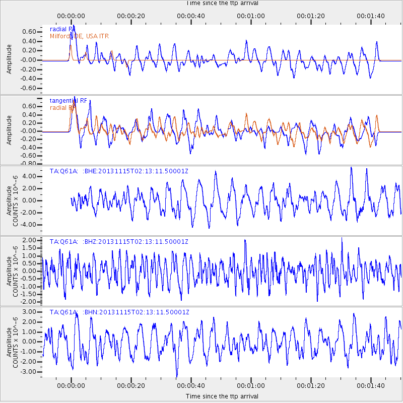
Q61A Milford, DE, USA - Earthquake Result Viewer
*The percent match for this event was below the threshold and hence no stack was calculated.
| Earthquake location: |
Hokkaido, Japan Region |
| Earthquake latitude/longitude: |
41.4/142.2 |
| Earthquake time(UTC): |
2013/11/15 (319) 02:00:33 GMT |
| Earthquake Depth: |
46 km |
| Earthquake Magnitude: |
5.5 MWB, 5.6 MWC |
| Earthquake Catalog/Contributor: |
NEIC PDE/NEIC COMCAT |
|
| Network: |
TA USArray Transportable Network (new EarthScope stations) |
| Station: |
Q61A Milford, DE, USA |
| Lat/Lon: |
38.88 N/75.33 W |
| Elevation: |
5.0 m |
|
| Distance: |
93.1 deg |
| Az: |
28.415 deg |
| Baz: |
332.713 deg |
| Ray Param: |
$rayparam |
*The percent match for this event was below the threshold and hence was not used in the summary stack. |
|
| Radial Match: |
62.117153 % |
| Radial Bump: |
400 |
| Transverse Match: |
31.953981 % |
| Transverse Bump: |
281 |
| SOD ConfigId: |
626651 |
| Insert Time: |
2014-04-19 15:19:01.231 +0000 |
| GWidth: |
2.5 |
| Max Bumps: |
400 |
| Tol: |
0.001 |
|
Signal To Noise
| Channel | StoN | STA | LTA |
| TA:Q61A: :BHZ:20131115T02:13:11.50001Z | 0.9820901 | 6.9671796E-7 | 7.094237E-7 |
| TA:Q61A: :BHN:20131115T02:13:11.50001Z | 1.3270825 | 1.8310144E-6 | 1.3797292E-6 |
| TA:Q61A: :BHE:20131115T02:13:11.50001Z | 1.567234 | 1.7732207E-6 | 1.1314332E-6 |
| Arrivals |
| Ps | |
| PpPs | |
| PsPs/PpSs | |


