You are here: Home > Network List > G - GEOSCOPE Stations List
> Station NOUC Port Laguerre, New Caledonia > Earthquake Result Viewer
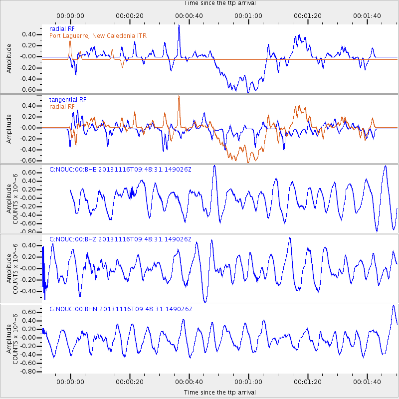
NOUC Port Laguerre, New Caledonia - Earthquake Result Viewer
*The percent match for this event was below the threshold and hence no stack was calculated.
| Earthquake location: |
Scotia Sea |
| Earthquake latitude/longitude: |
-60.3/-46.4 |
| Earthquake time(UTC): |
2013/11/16 (320) 09:35:46 GMT |
| Earthquake Depth: |
10 km |
| Earthquake Magnitude: |
5.5 MWB, 5.6 MWC |
| Earthquake Catalog/Contributor: |
NEIC PDE/NEIC COMCAT |
|
| Network: |
G GEOSCOPE |
| Station: |
NOUC Port Laguerre, New Caledonia |
| Lat/Lon: |
22.10 S/166.30 E |
| Elevation: |
112 m |
|
| Distance: |
93.7 deg |
| Az: |
210.163 deg |
| Baz: |
164.345 deg |
| Ray Param: |
$rayparam |
*The percent match for this event was below the threshold and hence was not used in the summary stack. |
|
| Radial Match: |
32.97194 % |
| Radial Bump: |
400 |
| Transverse Match: |
54.373764 % |
| Transverse Bump: |
400 |
| SOD ConfigId: |
626651 |
| Insert Time: |
2014-04-19 15:33:10.621 +0000 |
| GWidth: |
2.5 |
| Max Bumps: |
400 |
| Tol: |
0.001 |
|
Signal To Noise
| Channel | StoN | STA | LTA |
| G:NOUC:00:BHZ:20131116T09:48:31.149026Z | 1.2698948 | 2.4768207E-7 | 1.9504141E-7 |
| G:NOUC:00:BHN:20131116T09:48:31.149026Z | 1.1008518 | 4.2498573E-7 | 3.8605174E-7 |
| G:NOUC:00:BHE:20131116T09:48:31.149026Z | 0.70087546 | 1.6309667E-7 | 2.3270422E-7 |
| Arrivals |
| Ps | |
| PpPs | |
| PsPs/PpSs | |


