You are here: Home > Network List > TJ - Tajikistan National Seismic Network Stations List
> Station GARM Garm, Tajikistan > Earthquake Result Viewer
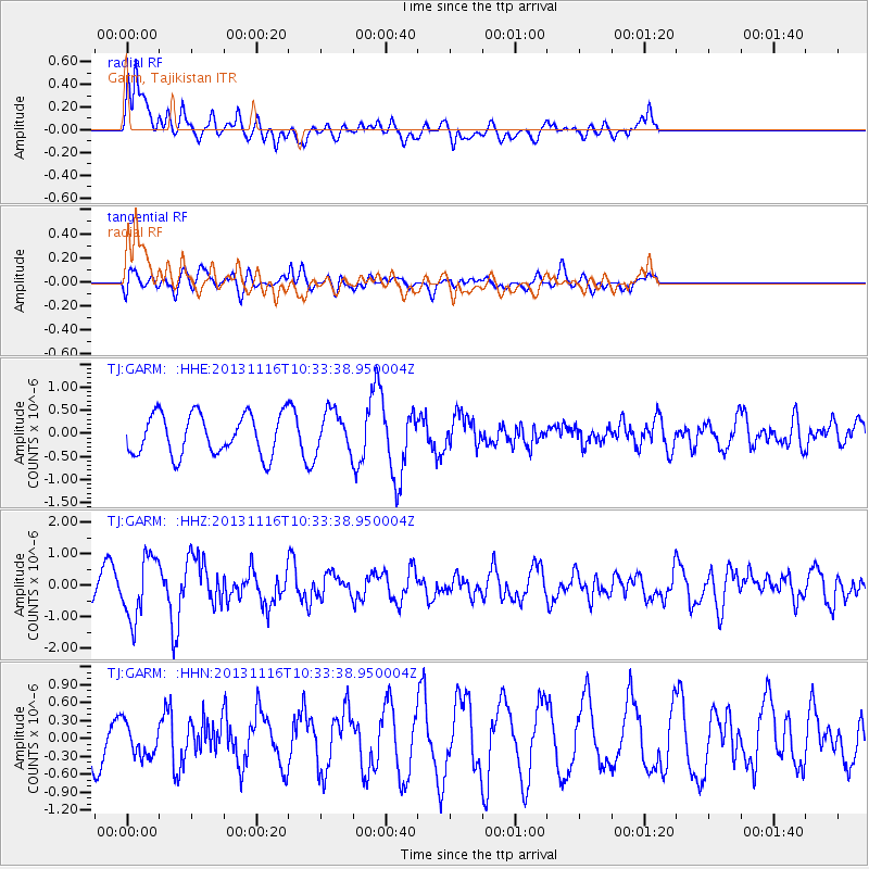
GARM Garm, Tajikistan - Earthquake Result Viewer
*The percent match for this event was below the threshold and hence no stack was calculated.
| Earthquake location: |
Off W Coast Of Northern Sumatra |
| Earthquake latitude/longitude: |
4.2/90.1 |
| Earthquake time(UTC): |
2013/11/16 (320) 10:26:43 GMT |
| Earthquake Depth: |
10 km |
| Earthquake Magnitude: |
5.7 MWB, 5.7 MWC |
| Earthquake Catalog/Contributor: |
NEIC PDE/NEIC COMCAT |
|
| Network: |
TJ Tajikistan National Seismic Network |
| Station: |
GARM Garm, Tajikistan |
| Lat/Lon: |
39.00 N/70.32 E |
| Elevation: |
1305 m |
|
| Distance: |
39.0 deg |
| Az: |
335.27 deg |
| Baz: |
147.625 deg |
| Ray Param: |
$rayparam |
*The percent match for this event was below the threshold and hence was not used in the summary stack. |
|
| Radial Match: |
71.1074 % |
| Radial Bump: |
400 |
| Transverse Match: |
32.2679 % |
| Transverse Bump: |
400 |
| SOD ConfigId: |
626651 |
| Insert Time: |
2014-04-19 15:44:43.729 +0000 |
| GWidth: |
2.5 |
| Max Bumps: |
400 |
| Tol: |
0.001 |
|
Signal To Noise
| Channel | StoN | STA | LTA |
| TJ:GARM: :HHZ:20131116T10:33:38.950004Z | 1.6114796 | 9.795372E-7 | 6.0784953E-7 |
| TJ:GARM: :HHN:20131116T10:33:38.950004Z | 0.4272417 | 2.8466772E-7 | 6.6629195E-7 |
| TJ:GARM: :HHE:20131116T10:33:38.950004Z | 1.0106113 | 4.4346456E-7 | 4.3880823E-7 |
| Arrivals |
| Ps | |
| PpPs | |
| PsPs/PpSs | |


