You are here: Home > Network List > IW - Intermountain West Stations List
> Station DLMT Dillon, Montana, USA > Earthquake Result Viewer
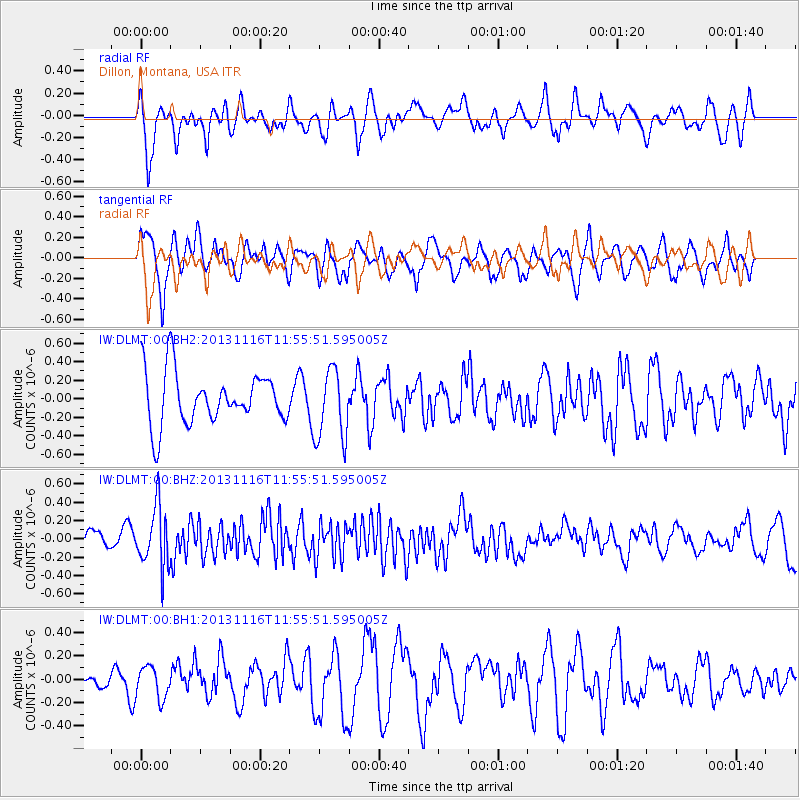
DLMT Dillon, Montana, USA - Earthquake Result Viewer
*The percent match for this event was below the threshold and hence no stack was calculated.
| Earthquake location: |
Near East Coast Of Honshu, Japan |
| Earthquake latitude/longitude: |
35.6/140.2 |
| Earthquake time(UTC): |
2013/11/16 (320) 11:44:41 GMT |
| Earthquake Depth: |
59 km |
| Earthquake Magnitude: |
5.5 MWB, 5.5 MWC, 5.6 MWC |
| Earthquake Catalog/Contributor: |
NEIC PDE/NEIC COMCAT |
|
| Network: |
IW Intermountain West |
| Station: |
DLMT Dillon, Montana, USA |
| Lat/Lon: |
45.36 N/112.60 W |
| Elevation: |
1569 m |
|
| Distance: |
76.1 deg |
| Az: |
43.922 deg |
| Baz: |
306.696 deg |
| Ray Param: |
$rayparam |
*The percent match for this event was below the threshold and hence was not used in the summary stack. |
|
| Radial Match: |
69.290276 % |
| Radial Bump: |
400 |
| Transverse Match: |
54.36876 % |
| Transverse Bump: |
400 |
| SOD ConfigId: |
626651 |
| Insert Time: |
2014-04-19 16:00:28.857 +0000 |
| GWidth: |
2.5 |
| Max Bumps: |
400 |
| Tol: |
0.001 |
|
Signal To Noise
| Channel | StoN | STA | LTA |
| IW:DLMT:00:BHZ:20131116T11:55:51.595005Z | 3.4426003 | 3.2669584E-7 | 9.489799E-8 |
| IW:DLMT:00:BH1:20131116T11:55:51.595005Z | 0.8901023 | 1.3521785E-7 | 1.5191269E-7 |
| IW:DLMT:00:BH2:20131116T11:55:51.595005Z | 1.3596224 | 3.8251525E-7 | 2.8133937E-7 |
| Arrivals |
| Ps | |
| PpPs | |
| PsPs/PpSs | |


