You are here: Home > Network List > TA - USArray Transportable Network (new EarthScope stations) Stations List
> Station P59A Jarrettsville, MD, USA > Earthquake Result Viewer
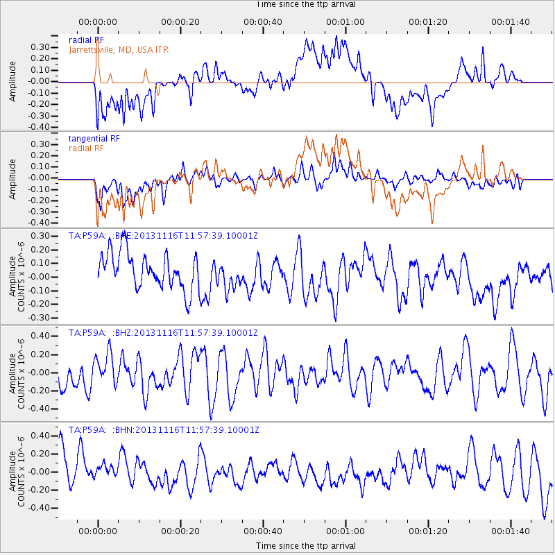
P59A Jarrettsville, MD, USA - Earthquake Result Viewer
*The percent match for this event was below the threshold and hence no stack was calculated.
| Earthquake location: |
Near East Coast Of Honshu, Japan |
| Earthquake latitude/longitude: |
35.6/140.2 |
| Earthquake time(UTC): |
2013/11/16 (320) 11:44:41 GMT |
| Earthquake Depth: |
59 km |
| Earthquake Magnitude: |
5.5 MWB, 5.5 MWC, 5.6 MWC |
| Earthquake Catalog/Contributor: |
NEIC PDE/NEIC COMCAT |
|
| Network: |
TA USArray Transportable Network (new EarthScope stations) |
| Station: |
P59A Jarrettsville, MD, USA |
| Lat/Lon: |
39.61 N/76.43 W |
| Elevation: |
157 m |
|
| Distance: |
97.9 deg |
| Az: |
27.7 deg |
| Baz: |
330.636 deg |
| Ray Param: |
$rayparam |
*The percent match for this event was below the threshold and hence was not used in the summary stack. |
|
| Radial Match: |
46.98009 % |
| Radial Bump: |
400 |
| Transverse Match: |
49.661045 % |
| Transverse Bump: |
400 |
| SOD ConfigId: |
626651 |
| Insert Time: |
2014-04-19 16:13:12.194 +0000 |
| GWidth: |
2.5 |
| Max Bumps: |
400 |
| Tol: |
0.001 |
|
Signal To Noise
| Channel | StoN | STA | LTA |
| TA:P59A: :BHZ:20131116T11:57:39.10001Z | 1.5016371 | 1.8069969E-7 | 1.2033513E-7 |
| TA:P59A: :BHN:20131116T11:57:39.10001Z | 0.8162663 | 2.268327E-7 | 2.7789056E-7 |
| TA:P59A: :BHE:20131116T11:57:39.10001Z | 0.83287513 | 1.0906165E-7 | 1.3094598E-7 |
| Arrivals |
| Ps | |
| PpPs | |
| PsPs/PpSs | |


