You are here: Home > Network List > US - United States National Seismic Network Stations List
> Station EGMT Eagleton, Montana, USA > Earthquake Result Viewer
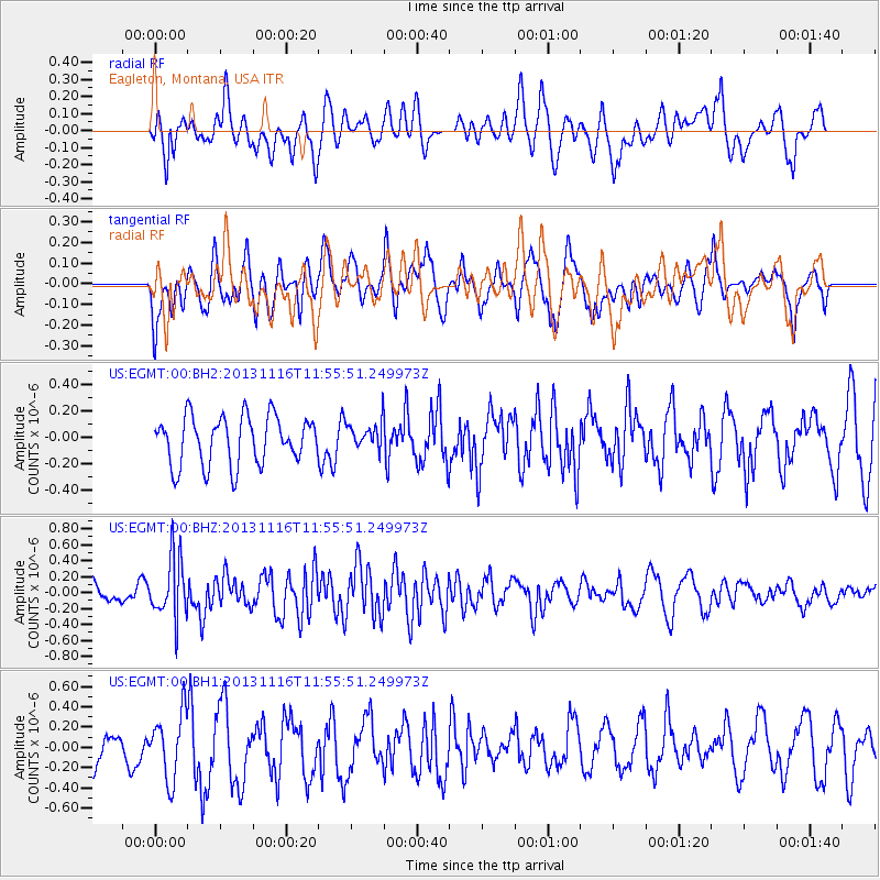
EGMT Eagleton, Montana, USA - Earthquake Result Viewer
*The percent match for this event was below the threshold and hence no stack was calculated.
| Earthquake location: |
Near East Coast Of Honshu, Japan |
| Earthquake latitude/longitude: |
35.6/140.2 |
| Earthquake time(UTC): |
2013/11/16 (320) 11:44:41 GMT |
| Earthquake Depth: |
59 km |
| Earthquake Magnitude: |
5.5 MWB, 5.5 MWC, 5.6 MWC |
| Earthquake Catalog/Contributor: |
NEIC PDE/NEIC COMCAT |
|
| Network: |
US United States National Seismic Network |
| Station: |
EGMT Eagleton, Montana, USA |
| Lat/Lon: |
48.02 N/109.75 W |
| Elevation: |
1055 m |
|
| Distance: |
76.0 deg |
| Az: |
40.519 deg |
| Baz: |
307.937 deg |
| Ray Param: |
$rayparam |
*The percent match for this event was below the threshold and hence was not used in the summary stack. |
|
| Radial Match: |
48.46793 % |
| Radial Bump: |
400 |
| Transverse Match: |
48.301846 % |
| Transverse Bump: |
400 |
| SOD ConfigId: |
626651 |
| Insert Time: |
2014-04-19 16:15:25.516 +0000 |
| GWidth: |
2.5 |
| Max Bumps: |
400 |
| Tol: |
0.001 |
|
Signal To Noise
| Channel | StoN | STA | LTA |
| US:EGMT:00:BHZ:20131116T11:55:51.249973Z | 2.3594642 | 3.751455E-7 | 1.5899606E-7 |
| US:EGMT:00:BH1:20131116T11:55:51.249973Z | 1.4809023 | 3.2288335E-7 | 2.1803152E-7 |
| US:EGMT:00:BH2:20131116T11:55:51.249973Z | 0.5591379 | 1.021178E-7 | 1.826344E-7 |
| Arrivals |
| Ps | |
| PpPs | |
| PsPs/PpSs | |


