You are here: Home > Network List > G - GEOSCOPE Stations List
> Station MPG Montagne des Peres, French Guyana > Earthquake Result Viewer
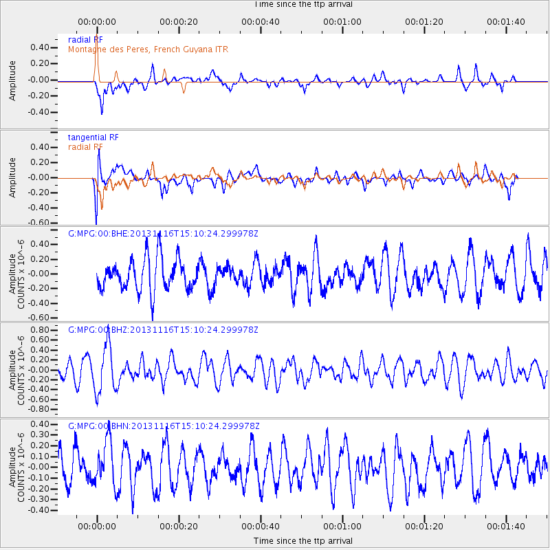
MPG Montagne des Peres, French Guyana - Earthquake Result Viewer
*The percent match for this event was below the threshold and hence no stack was calculated.
| Earthquake location: |
Scotia Sea |
| Earthquake latitude/longitude: |
-60.3/-46.4 |
| Earthquake time(UTC): |
2013/11/16 (320) 15:00:12 GMT |
| Earthquake Depth: |
10 km |
| Earthquake Magnitude: |
5.5 MWC, 5.5 MWC |
| Earthquake Catalog/Contributor: |
NEIC PDE/NEIC COMCAT |
|
| Network: |
G GEOSCOPE |
| Station: |
MPG Montagne des Peres, French Guyana |
| Lat/Lon: |
5.11 N/52.64 W |
| Elevation: |
147 m |
|
| Distance: |
65.4 deg |
| Az: |
353.125 deg |
| Baz: |
176.574 deg |
| Ray Param: |
$rayparam |
*The percent match for this event was below the threshold and hence was not used in the summary stack. |
|
| Radial Match: |
62.38471 % |
| Radial Bump: |
400 |
| Transverse Match: |
66.65439 % |
| Transverse Bump: |
400 |
| SOD ConfigId: |
626651 |
| Insert Time: |
2014-04-19 16:20:56.446 +0000 |
| GWidth: |
2.5 |
| Max Bumps: |
400 |
| Tol: |
0.001 |
|
Signal To Noise
| Channel | StoN | STA | LTA |
| G:MPG:00:BHZ:20131116T15:10:24.299978Z | 2.2010572 | 4.834463E-7 | 2.1964277E-7 |
| G:MPG:00:BHN:20131116T15:10:24.299978Z | 1.1903627 | 2.1212355E-7 | 1.7820078E-7 |
| G:MPG:00:BHE:20131116T15:10:24.299978Z | 0.4250276 | 9.172752E-8 | 2.1581543E-7 |
| Arrivals |
| Ps | |
| PpPs | |
| PsPs/PpSs | |


