You are here: Home > Network List > TA - USArray Transportable Network (new EarthScope stations) Stations List
> Station 155A Kite, GA, USA > Earthquake Result Viewer
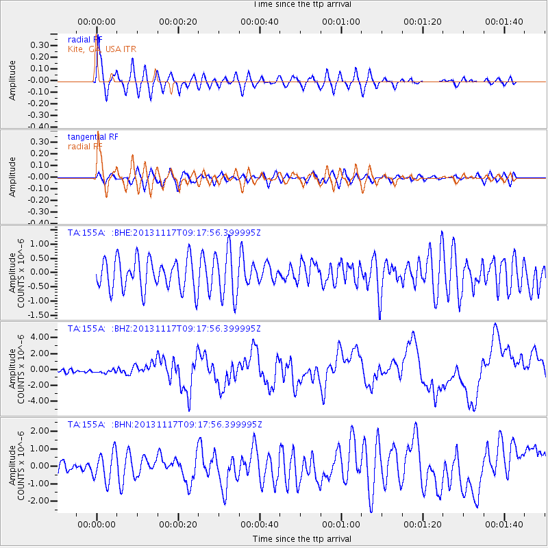
155A Kite, GA, USA - Earthquake Result Viewer
*The percent match for this event was below the threshold and hence no stack was calculated.
| Earthquake location: |
Scotia Sea |
| Earthquake latitude/longitude: |
-60.3/-46.4 |
| Earthquake time(UTC): |
2013/11/17 (321) 09:04:55 GMT |
| Earthquake Depth: |
10 km |
| Earthquake Magnitude: |
7.7 MWW, 7.6 MWC, 7.7 MWW, 7.8 MI, 7.8 MWC |
| Earthquake Catalog/Contributor: |
NEIC PDE/NEIC COMCAT |
|
| Network: |
TA USArray Transportable Network (new EarthScope stations) |
| Station: |
155A Kite, GA, USA |
| Lat/Lon: |
32.62 N/82.47 W |
| Elevation: |
93 m |
|
| Distance: |
97.2 deg |
| Az: |
329.951 deg |
| Baz: |
162.799 deg |
| Ray Param: |
$rayparam |
*The percent match for this event was below the threshold and hence was not used in the summary stack. |
|
| Radial Match: |
70.62542 % |
| Radial Bump: |
400 |
| Transverse Match: |
50.129364 % |
| Transverse Bump: |
400 |
| SOD ConfigId: |
626651 |
| Insert Time: |
2014-04-19 16:31:20.124 +0000 |
| GWidth: |
2.5 |
| Max Bumps: |
400 |
| Tol: |
0.001 |
|
Signal To Noise
| Channel | StoN | STA | LTA |
| TA:155A: :BHZ:20131117T09:17:56.399995Z | 1.135611 | 2.2209615E-7 | 1.9557413E-7 |
| TA:155A: :BHN:20131117T09:17:56.399995Z | 1.9739172 | 8.4762445E-7 | 4.2941238E-7 |
| TA:155A: :BHE:20131117T09:17:56.399995Z | 1.5707767 | 8.5150305E-7 | 5.4209045E-7 |
| Arrivals |
| Ps | |
| PpPs | |
| PsPs/PpSs | |


