You are here: Home > Network List > TA - USArray Transportable Network (new EarthScope stations) Stations List
> Station 157A Early Branch, SC, USA > Earthquake Result Viewer
157A Early Branch, SC, USA - Earthquake Result Viewer

| Earthquake location: |
Scotia Sea |
| Earthquake latitude/longitude: |
-60.3/-46.4 |
| Earthquake time(UTC): |
2013/11/17 (321) 09:04:55 GMT |
| Earthquake Depth: |
10 km |
| Earthquake Magnitude: |
7.7 MWW, 7.6 MWC, 7.7 MWW, 7.8 MI, 7.8 MWC |
| Earthquake Catalog/Contributor: |
NEIC PDE/NEIC COMCAT |
|
| Network: |
TA USArray Transportable Network (new EarthScope stations) |
| Station: |
157A Early Branch, SC, USA |
| Lat/Lon: |
32.68 N/81.00 W |
| Elevation: |
21 m |
|
| Distance: |
96.9 deg |
| Az: |
331.162 deg |
| Baz: |
163.44 deg |
| Ray Param: |
0.040381007 |
| Estimated Moho Depth: |
50.25 km |
| Estimated Crust Vp/Vs: |
1.62 |
| Assumed Crust Vp: |
6.565 km/s |
| Estimated Crust Vs: |
4.052 km/s |
| Estimated Crust Poisson's Ratio: |
0.19 |
|
| Radial Match: |
80.49084 % |
| Radial Bump: |
400 |
| Transverse Match: |
49.060654 % |
| Transverse Bump: |
400 |
| SOD ConfigId: |
626651 |
| Insert Time: |
2014-04-19 16:31:24.639 +0000 |
| GWidth: |
2.5 |
| Max Bumps: |
400 |
| Tol: |
0.001 |
|
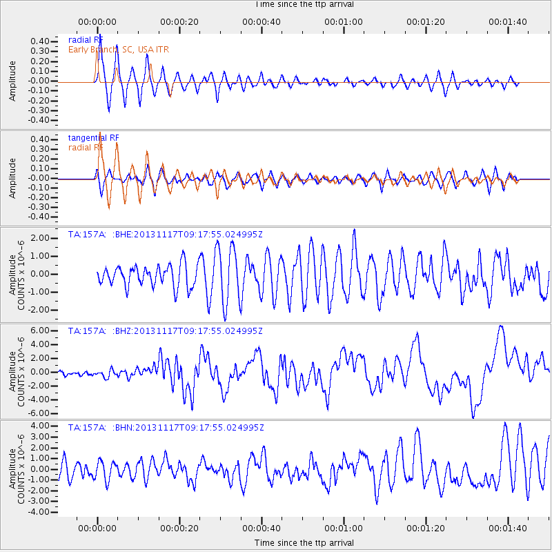
Signal To Noise
| Channel | StoN | STA | LTA |
| TA:157A: :BHZ:20131117T09:17:55.024995Z | 1.3531128 | 5.1528957E-7 | 3.808179E-7 |
| TA:157A: :BHN:20131117T09:17:55.024995Z | 1.3383722 | 8.920644E-7 | 6.665294E-7 |
| TA:157A: :BHE:20131117T09:17:55.024995Z | 2.7548096 | 1.5755242E-6 | 5.719176E-7 |
| Arrivals |
| Ps | 4.9 SECOND |
| PpPs | 20 SECOND |
| PsPs/PpSs | 24 SECOND |


