You are here: Home > Network List > TA - USArray Transportable Network (new EarthScope stations) Stations List
> Station 109C Camp Elliot, Mirimar, CA, USA > Earthquake Result Viewer
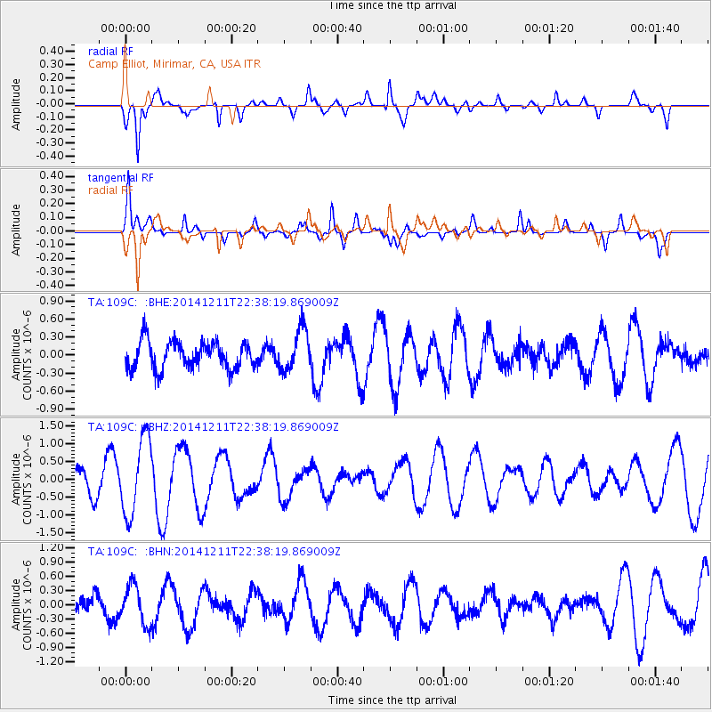
109C Camp Elliot, Mirimar, CA, USA - Earthquake Result Viewer
*The percent match for this event was below the threshold and hence no stack was calculated.
| Earthquake location: |
Fiji Islands Region |
| Earthquake latitude/longitude: |
-20.9/-178.9 |
| Earthquake time(UTC): |
2014/12/11 (345) 22:27:45 GMT |
| Earthquake Depth: |
604 km |
| Earthquake Magnitude: |
5.7 MW, 5.0 mb |
| Earthquake Catalog/Contributor: |
ISC/ISC |
|
| Network: |
TA USArray Transportable Network (new EarthScope stations) |
| Station: |
109C Camp Elliot, Mirimar, CA, USA |
| Lat/Lon: |
32.89 N/117.11 W |
| Elevation: |
150 m |
|
| Distance: |
79.7 deg |
| Az: |
48.921 deg |
| Baz: |
236.875 deg |
| Ray Param: |
$rayparam |
*The percent match for this event was below the threshold and hence was not used in the summary stack. |
|
| Radial Match: |
65.97215 % |
| Radial Bump: |
400 |
| Transverse Match: |
63.95182 % |
| Transverse Bump: |
400 |
| SOD ConfigId: |
3390531 |
| Insert Time: |
2019-04-15 12:42:30.538 +0000 |
| GWidth: |
2.5 |
| Max Bumps: |
400 |
| Tol: |
0.001 |
|
Signal To Noise
| Channel | StoN | STA | LTA |
| TA:109C: :BHZ:20141211T22:38:19.869009Z | 1.8052218 | 1.0730877E-6 | 5.9443533E-7 |
| TA:109C: :BHN:20141211T22:38:19.869009Z | 0.8511543 | 4.0976263E-7 | 4.8141993E-7 |
| TA:109C: :BHE:20141211T22:38:19.869009Z | 1.5777909 | 3.5700393E-7 | 2.2626821E-7 |
| Arrivals |
| Ps | |
| PpPs | |
| PsPs/PpSs | |


