You are here: Home > Network List > CU - Caribbean Network (USGS) Stations List
> Station BBGH Gun Hill, Barbados > Earthquake Result Viewer
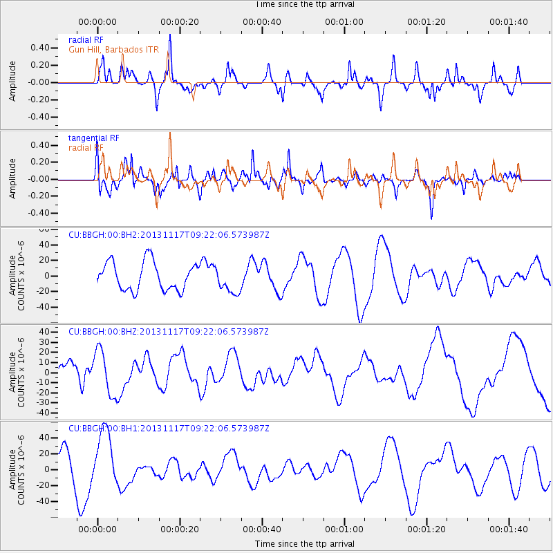
BBGH Gun Hill, Barbados - Earthquake Result Viewer
*The percent match for this event was below the threshold and hence no stack was calculated.
| Earthquake location: |
Scotia Sea |
| Earthquake latitude/longitude: |
-60.5/-45.2 |
| Earthquake time(UTC): |
2013/11/17 (321) 09:11:01 GMT |
| Earthquake Depth: |
16 km |
| Earthquake Magnitude: |
5.8 MB |
| Earthquake Catalog/Contributor: |
NEIC PDE/NEIC COMCAT |
|
| Network: |
CU Caribbean Network (USGS) |
| Station: |
BBGH Gun Hill, Barbados |
| Lat/Lon: |
13.14 N/59.56 W |
| Elevation: |
180 m |
|
| Distance: |
74.3 deg |
| Az: |
345.476 deg |
| Baz: |
172.675 deg |
| Ray Param: |
$rayparam |
*The percent match for this event was below the threshold and hence was not used in the summary stack. |
|
| Radial Match: |
57.140984 % |
| Radial Bump: |
303 |
| Transverse Match: |
68.14587 % |
| Transverse Bump: |
400 |
| SOD ConfigId: |
626651 |
| Insert Time: |
2014-04-19 16:34:10.512 +0000 |
| GWidth: |
2.5 |
| Max Bumps: |
400 |
| Tol: |
0.001 |
|
Signal To Noise
| Channel | StoN | STA | LTA |
| CU:BBGH:00:BHZ:20131117T09:22:06.573987Z | 1.3742349 | 2.2961476E-5 | 1.6708553E-5 |
| CU:BBGH:00:BH1:20131117T09:22:06.573987Z | 2.652171 | 3.652221E-5 | 1.3770687E-5 |
| CU:BBGH:00:BH2:20131117T09:22:06.573987Z | 0.9671883 | 1.7489325E-5 | 1.8082648E-5 |
| Arrivals |
| Ps | |
| PpPs | |
| PsPs/PpSs | |


