You are here: Home > Network List > G - GEOSCOPE Stations List
> Station PPTF Pamatai - Papeete - Tahiti island - French Polynesia, France > Earthquake Result Viewer
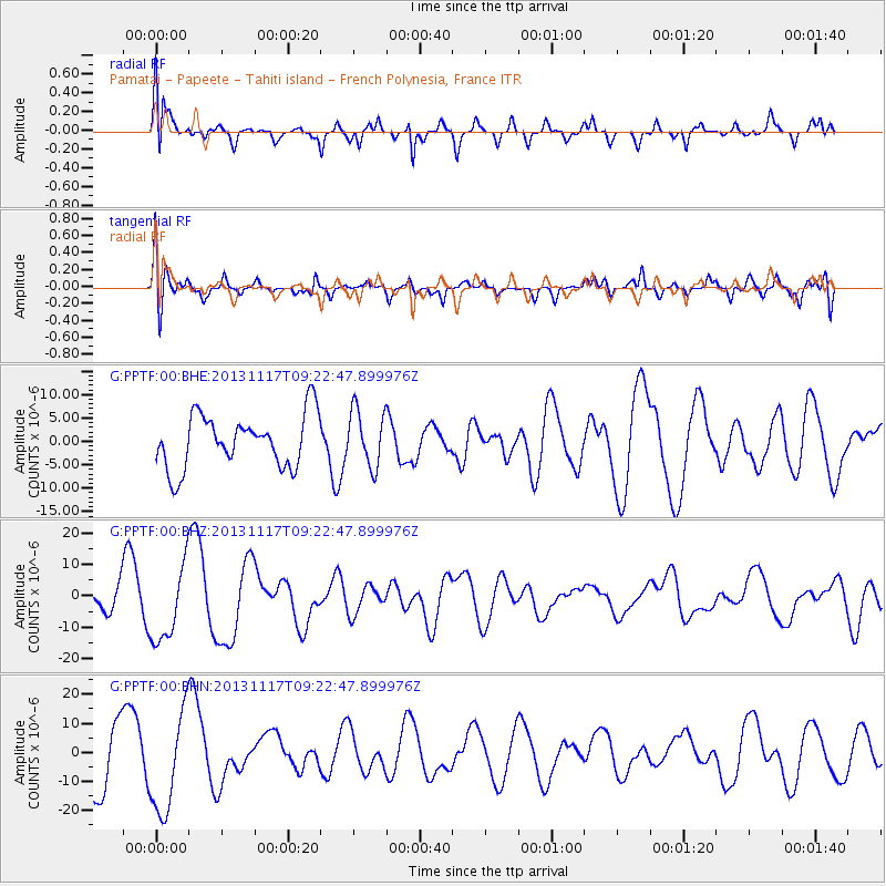
PPTF Pamatai - Papeete - Tahiti island - French Polynesia, France - Earthquake Result Viewer
*The percent match for this event was below the threshold and hence no stack was calculated.
| Earthquake location: |
Scotia Sea |
| Earthquake latitude/longitude: |
-60.5/-45.2 |
| Earthquake time(UTC): |
2013/11/17 (321) 09:11:01 GMT |
| Earthquake Depth: |
16 km |
| Earthquake Magnitude: |
5.8 MB |
| Earthquake Catalog/Contributor: |
NEIC PDE/NEIC COMCAT |
|
| Network: |
G GEOSCOPE |
| Station: |
PPTF Pamatai - Papeete - Tahiti island - French Polynesia, France |
| Lat/Lon: |
17.59 S/149.57 W |
| Elevation: |
705 m |
|
| Distance: |
81.7 deg |
| Az: |
249.029 deg |
| Baz: |
150.997 deg |
| Ray Param: |
$rayparam |
*The percent match for this event was below the threshold and hence was not used in the summary stack. |
|
| Radial Match: |
62.609306 % |
| Radial Bump: |
400 |
| Transverse Match: |
49.42426 % |
| Transverse Bump: |
400 |
| SOD ConfigId: |
626651 |
| Insert Time: |
2014-04-19 16:34:33.735 +0000 |
| GWidth: |
2.5 |
| Max Bumps: |
400 |
| Tol: |
0.001 |
|
Signal To Noise
| Channel | StoN | STA | LTA |
| G:PPTF:00:BHZ:20131117T09:22:47.899976Z | 2.1214721 | 1.2413254E-5 | 5.8512455E-6 |
| G:PPTF:00:BHN:20131117T09:22:47.899976Z | 1.7152214 | 1.7526183E-5 | 1.0218029E-5 |
| G:PPTF:00:BHE:20131117T09:22:47.899976Z | 1.0707157 | 6.042441E-6 | 5.6433664E-6 |
| Arrivals |
| Ps | |
| PpPs | |
| PsPs/PpSs | |


