You are here: Home > Network List > US - United States National Seismic Network Stations List
> Station BRAL Brewton, Alabama, USA > Earthquake Result Viewer
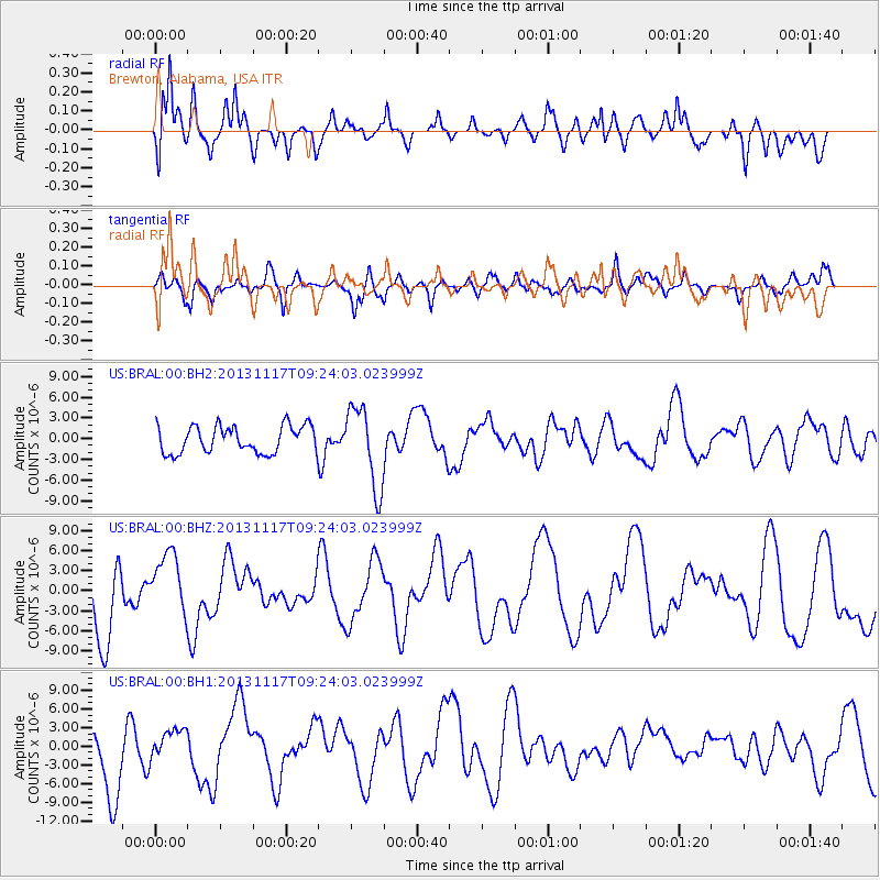
BRAL Brewton, Alabama, USA - Earthquake Result Viewer
*The percent match for this event was below the threshold and hence no stack was calculated.
| Earthquake location: |
Scotia Sea |
| Earthquake latitude/longitude: |
-60.5/-45.2 |
| Earthquake time(UTC): |
2013/11/17 (321) 09:11:01 GMT |
| Earthquake Depth: |
16 km |
| Earthquake Magnitude: |
5.8 MB |
| Earthquake Catalog/Contributor: |
NEIC PDE/NEIC COMCAT |
|
| Network: |
US United States National Seismic Network |
| Station: |
BRAL Brewton, Alabama, USA |
| Lat/Lon: |
31.01 N/87.06 W |
| Elevation: |
61 m |
|
| Distance: |
97.4 deg |
| Az: |
324.72 deg |
| Baz: |
160.539 deg |
| Ray Param: |
$rayparam |
*The percent match for this event was below the threshold and hence was not used in the summary stack. |
|
| Radial Match: |
70.506294 % |
| Radial Bump: |
400 |
| Transverse Match: |
58.09217 % |
| Transverse Bump: |
400 |
| SOD ConfigId: |
626651 |
| Insert Time: |
2014-04-19 16:38:06.061 +0000 |
| GWidth: |
2.5 |
| Max Bumps: |
400 |
| Tol: |
0.001 |
|
Signal To Noise
| Channel | StoN | STA | LTA |
| US:BRAL:00:BHZ:20131117T09:24:03.023999Z | 0.63917065 | 4.5605243E-6 | 7.1350655E-6 |
| US:BRAL:00:BH1:20131117T09:24:03.023999Z | 0.4165746 | 2.557793E-6 | 6.14006E-6 |
| US:BRAL:00:BH2:20131117T09:24:03.023999Z | 2.6568973 | 5.208628E-6 | 1.9604174E-6 |
| Arrivals |
| Ps | |
| PpPs | |
| PsPs/PpSs | |


