You are here: Home > Network List > G - GEOSCOPE Stations List
> Station TAM Tamanrasset, Algeria > Earthquake Result Viewer
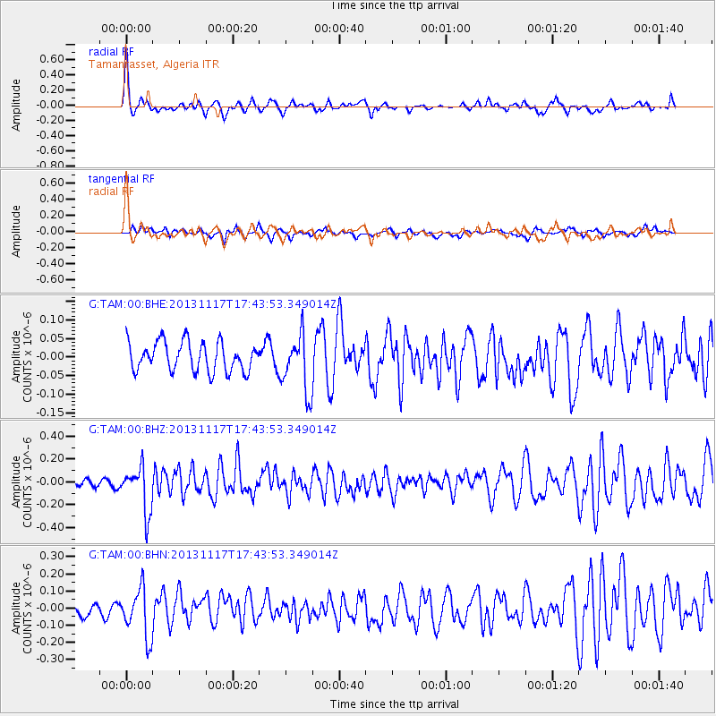
TAM Tamanrasset, Algeria - Earthquake Result Viewer
*The percent match for this event was below the threshold and hence no stack was calculated.
| Earthquake location: |
Ascension Island Region |
| Earthquake latitude/longitude: |
-10.3/-11.8 |
| Earthquake time(UTC): |
2013/11/17 (321) 17:37:14 GMT |
| Earthquake Depth: |
10 km |
| Earthquake Magnitude: |
5.5 MB, 5.4 MWC |
| Earthquake Catalog/Contributor: |
NEIC PDE/NEIC COMCAT |
|
| Network: |
G GEOSCOPE |
| Station: |
TAM Tamanrasset, Algeria |
| Lat/Lon: |
22.79 N/5.53 E |
| Elevation: |
1377 m |
|
| Distance: |
37.1 deg |
| Az: |
27.196 deg |
| Baz: |
209.165 deg |
| Ray Param: |
$rayparam |
*The percent match for this event was below the threshold and hence was not used in the summary stack. |
|
| Radial Match: |
69.95459 % |
| Radial Bump: |
321 |
| Transverse Match: |
57.3202 % |
| Transverse Bump: |
397 |
| SOD ConfigId: |
626651 |
| Insert Time: |
2014-04-19 16:46:21.901 +0000 |
| GWidth: |
2.5 |
| Max Bumps: |
400 |
| Tol: |
0.001 |
|
Signal To Noise
| Channel | StoN | STA | LTA |
| G:TAM:00:BHZ:20131117T17:43:53.349014Z | 2.7838013 | 2.0535722E-7 | 7.376864E-8 |
| G:TAM:00:BHN:20131117T17:43:53.349014Z | 2.883333 | 1.468283E-7 | 5.092312E-8 |
| G:TAM:00:BHE:20131117T17:43:53.349014Z | 1.9789377 | 7.732821E-8 | 3.9075616E-8 |
| Arrivals |
| Ps | |
| PpPs | |
| PsPs/PpSs | |


