You are here: Home > Network List > TA - USArray Transportable Network (new EarthScope stations) Stations List
> Station I42A Draeger Farm, Ripon, WI, USA > Earthquake Result Viewer
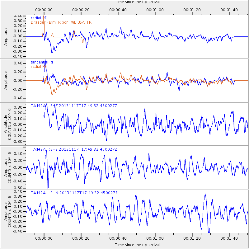
I42A Draeger Farm, Ripon, WI, USA - Earthquake Result Viewer
*The percent match for this event was below the threshold and hence no stack was calculated.
| Earthquake location: |
Ascension Island Region |
| Earthquake latitude/longitude: |
-10.3/-11.8 |
| Earthquake time(UTC): |
2013/11/17 (321) 17:37:14 GMT |
| Earthquake Depth: |
10 km |
| Earthquake Magnitude: |
5.5 MB, 5.4 MWC |
| Earthquake Catalog/Contributor: |
NEIC PDE/NEIC COMCAT |
|
| Network: |
TA USArray Transportable Network (new EarthScope stations) |
| Station: |
I42A Draeger Farm, Ripon, WI, USA |
| Lat/Lon: |
43.89 N/88.91 W |
| Elevation: |
298 m |
|
| Distance: |
87.9 deg |
| Az: |
315.159 deg |
| Baz: |
106.319 deg |
| Ray Param: |
$rayparam |
*The percent match for this event was below the threshold and hence was not used in the summary stack. |
|
| Radial Match: |
46.844376 % |
| Radial Bump: |
400 |
| Transverse Match: |
77.87197 % |
| Transverse Bump: |
400 |
| SOD ConfigId: |
626651 |
| Insert Time: |
2014-04-19 16:56:09.957 +0000 |
| GWidth: |
2.5 |
| Max Bumps: |
400 |
| Tol: |
0.001 |
|
Signal To Noise
| Channel | StoN | STA | LTA |
| TA:I42A: :BHZ:20131117T17:49:32.450027Z | 2.0605984 | 2.5925297E-7 | 1.2581441E-7 |
| TA:I42A: :BHN:20131117T17:49:32.450027Z | 1.318651 | 1.2305519E-7 | 9.3319E-8 |
| TA:I42A: :BHE:20131117T17:49:32.450027Z | 1.089681 | 1.4199138E-7 | 1.3030544E-7 |
| Arrivals |
| Ps | |
| PpPs | |
| PsPs/PpSs | |


